Ireland / Éire – Let’s explore here
What’s it like in Ireland?
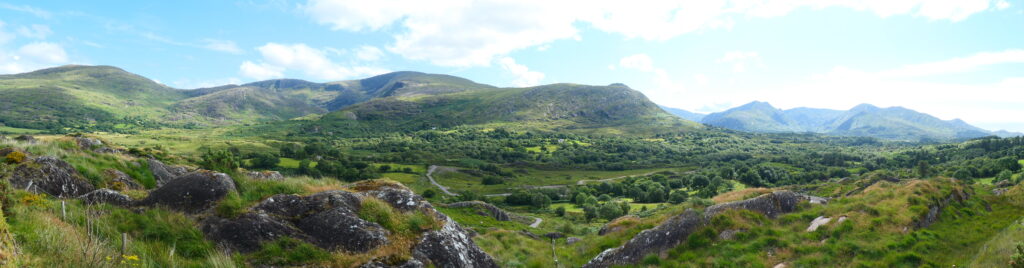
Ireland is a beautiful island comprising of low-lying mountains surrounding a central plain. It has a very rich history, both full of folklore as well as geopolitically. The majority of the southern part of the island of Ireland is the Republic of Ireland. The remaining one sixth of the island in the north is Northern Ireland, part of the United Kingdom.
The population is around 7 million people (2022); approximately five million live in the Republic and two million in Northern Ireland. Irish culture has had a significant influence on many other cultures, and continues to do so, especially in literature (think Samuel Beckett, James Joyce, George Bernard Shaw), music and the arts.
There are numerous coastal mountains surrounding a central plain. The highest point is Carrauntoohil in County Kerry in the south west of Ireland, at 3,407 ft (1,039m) above sea level.
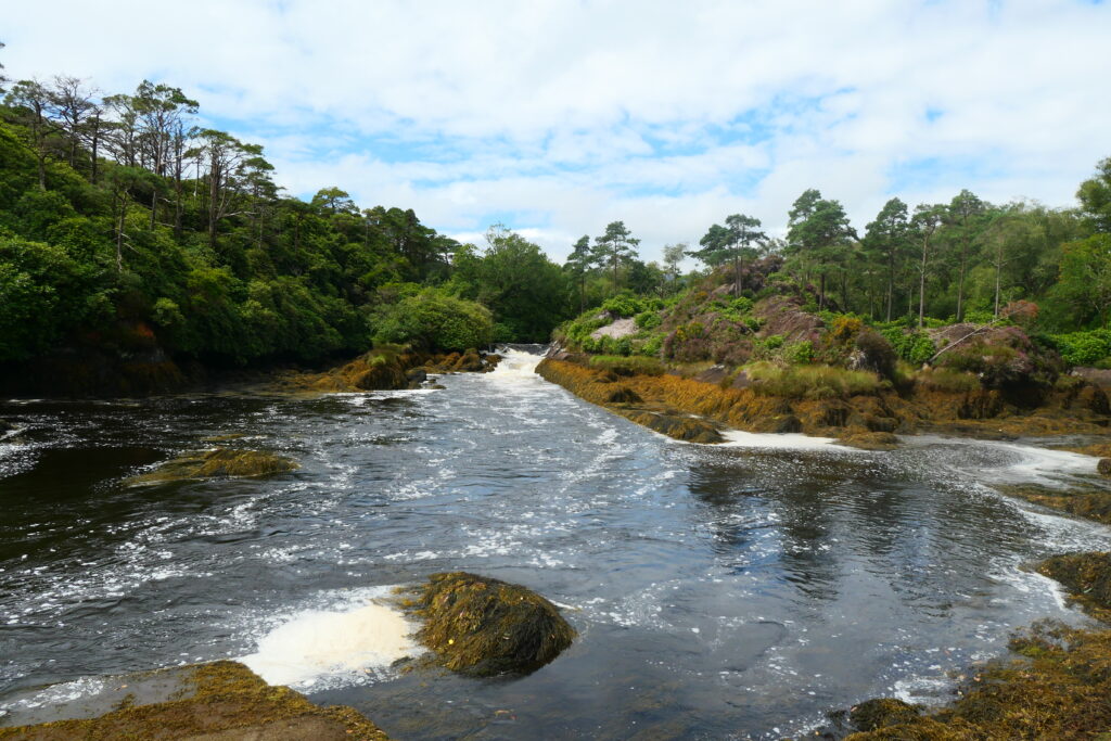
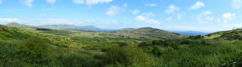
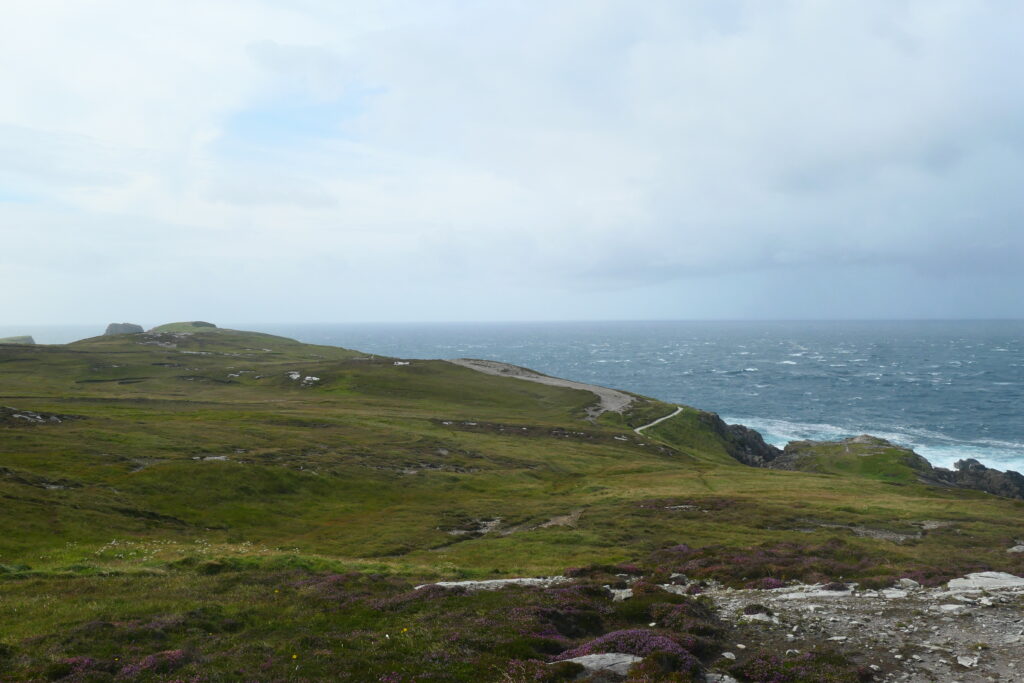
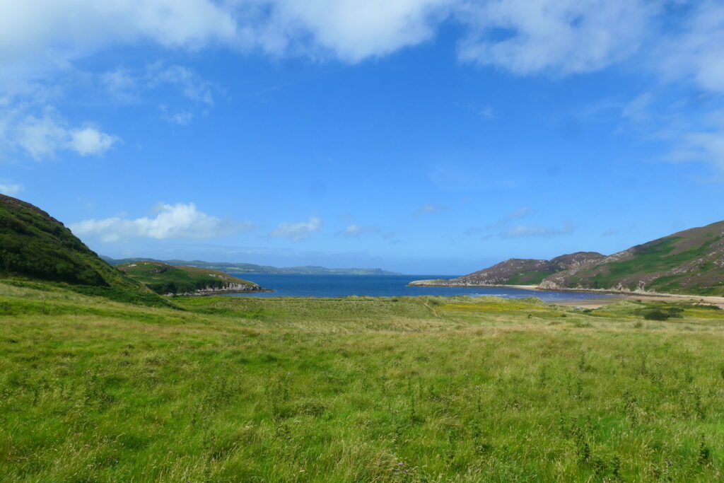
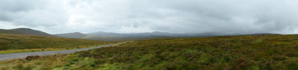
Our favourite areas are the Beara peninsula, Dun Chaoin, Kilcommon, the Iveragh Peninsula, Rostrevor and the Sperrin National Landscape; although the whole of the Wild Atlantic Way is pretty spectacular. Ireland is amazing!
A bit about the history of Ireland
Early History and Settlement
Ireland has a rich history that dates back thousands of years. The earliest inhabitants of Ireland were the Celts, who arrived around 500 BC. Over time, they developed a distinct culture and language, and the island became divided into several small kingdoms.
Christianity and the Medieval Period
In the 5th century, Saint Patrick brought Christianity to Ireland, significantly shaping its culture and society. By the 12th century, Ireland was a patchwork of Gaelic kingdoms, and the island began to face increasing English influence. In 1169, the Normans, who had invaded England, arrived in Ireland and began to establish control.
English Rule and Rebellions
Throughout the following centuries, the English crown sought to assert control over Ireland. Tensions between the English and the Irish led to several uprisings, most notably the Tudor Conquest in the 16th century, which resulted in the annexation of Ireland into the Kingdom of England. The Irish continued to resist English rule, with notable rebellions like the Irish Confederate Wars (1641-1653) and the Williamite War (1689-1691).
The Act of Union and Struggle for Independence
In 1801, the Act of Union merged the Kingdom of Ireland with Great Britain to form the United Kingdom of Great Britain and Ireland. Throughout the 19th century, Ireland struggled under British rule, with issues like poverty, famine, and a growing desire for independence. The Great Famine (1845-1852) caused the death of around a million people and led to mass emigration.
Home Rule and the Easter Rising
By the late 19th and early 20th centuries, the movement for Irish independence grew stronger. The Home Rule movement sought self-governance for Ireland within the United Kingdom, but it was opposed by unionists in the north. Tensions culminated in the Easter Rising of 1916, a failed rebellion that, despite its initial failure, spurred the demand for independence.
Irish War of Independence and Partition
Following the Easter Rising, the Irish War of Independence (1919-1921) broke out between Irish republicans and the British government. The war ended with the signing of the Anglo-Irish Treaty, which led to the creation of the Irish Free State in 1922, a self-governing dominion within the British Commonwealth. However, the treaty caused division, leading to the Irish Civil War (1922-1923). The island was also partitioned, with Northern Ireland remaining part of the United Kingdom.
Republic of Ireland and Modern History
The Irish Free State eventually became a republic, formally severing its ties with the British Commonwealth in 1949. Over the 20th and 21st centuries, Ireland transformed into a modern, democratic state. The Republic of Ireland became a member of the European Union in 1973, and the country saw significant economic growth during the late 20th century.
Northern Ireland, meanwhile, remained a part of the United Kingdom and experienced significant conflict, known as The Troubles (1960s-1998), between Catholic nationalists seeking unification with Ireland and Protestant unionists wanting to remain British. The Good Friday Agreement of 1998 largely ended the violence and established a devolved government in Northern Ireland.

Ireland road trip
For our Irish road trip we traveled from Scotland by ferry to Larne, Northern Ireland, before heading around the entire coast of the island of Ireland. We’d been to Ireland before, but had never circumnavigated its perimeter. The journey really enlightened us even more about the wonderful history of Ireland and its welcoming people.
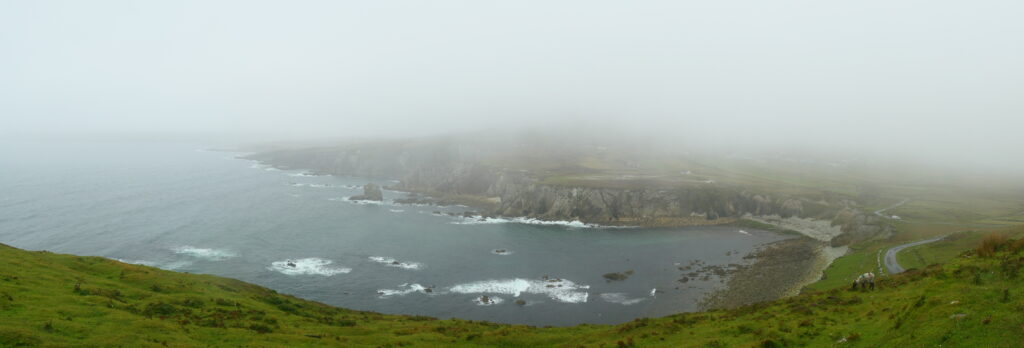
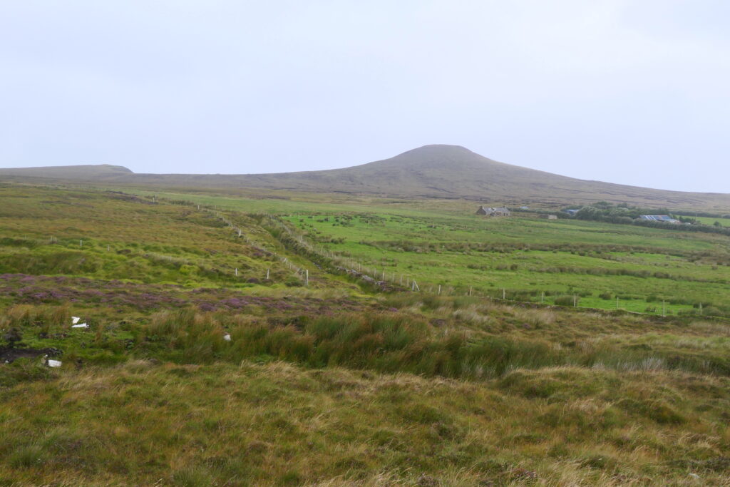
Our initial planned route took us anti-clockwise around Ireland. However the weather forecast made it clear that we should travel clockwise in order to avoid heavy Atlantic downpours and catch the sun. In the end on our mammoth trip we only experienced one full day of rain, one day of fog and one morning of mist, all the rest were sunny! Apparently we were extremely lucky, as everyone was telling us how it had been incessant rain prior to us turning up! Perhaps we had some of the famous Irish luck on our side 🙂
Map of our road trip through Ireland

This is a map of the actual route that we took on our Ireland road trip. The distance is approximately 1,700 miles (2,700km).
Our travels through Ireland and Northern Ireland took us from Larne – Belfast – Lisburn – Lough Neagh – Rathriland – Mourne mountains – Rostrevor – Trim castle – Dublin – Sally Gap – Glendalough – Wicklow – Wexford – Coolkenno – Waterford – Cork – Kinsale – Clonakilty – Mizen Head – Bantry – Glengariff – Adrigole – Lambs Head – Spunkane – St. Finian’s Bay – Valentia Island – Ross Castle – Killarney – Dun Chaoin – Stradbally – Tralee – Limerick – Lough Derg (Mountshannon) – Burren National Park – Galway – Spidall – Clifden – Letterfrack – Westport – Achill Island (White Cliffs of Ashleam – Dooega – Keem) – Kilgalligan – Céide Fields – Sligo – Donegal – Killybegs – Sliabh Liag – Glencolumbkille – Lough Barra Bog – Glenveagh – Fort Dunree – Portronan – Malin Head – Tremone Bay – Shrove – Redcastle – Derry – Sperrin National Landscape – Beaghmore Stone Circles – Binevenagh National Landscape – Giant’s Causeway – Larne
Our favourite places in the Republic of Ireland (for Northern Ireland, see the UK page)
These are some of the best places that we explored on our road trip through Ireland. We’ve put them in alphabetical order.
Achill Island, County Mayo
Achill Island is a lovely island in the west of Ireland, north west of Westport. It is the largest of Ireland’s Islands, covering about 57 square miles (148 square km), and is a stunning place to visit, due to the many dramatic cliff views. Connected to the mainland by a bridge, the island offers many stunning landscapes, including the majestic peaks of the Nephin Beg range. There are also some ancient sites to explore, including stone forts and the famous Deserted Village, remnants of a 19th-century famine-era settlement.
The island has a rich cultural heritage, with a strong connection to traditional Irish music, language, and folklore. The island is also home to a fairly unique blend of Irish and English-speaking communities, with much of the local population still speaking the Irish language.
Unfortunately for us, it’s one of the few places we’ve been that hasn’t been sunny!

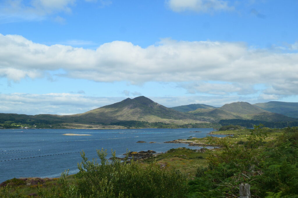
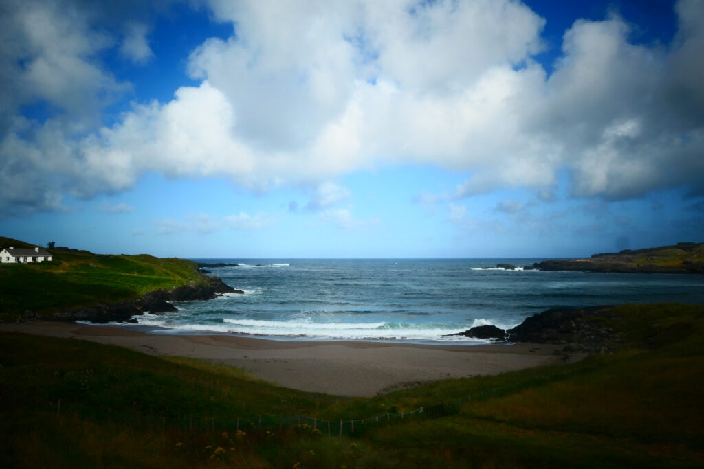
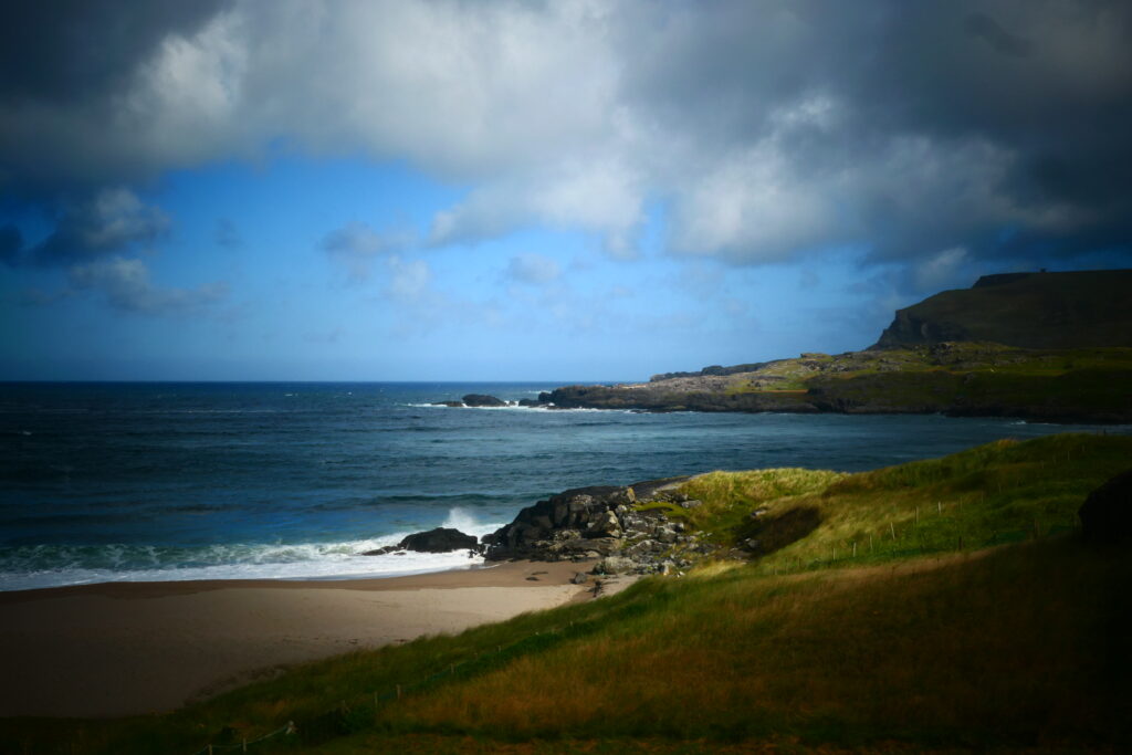
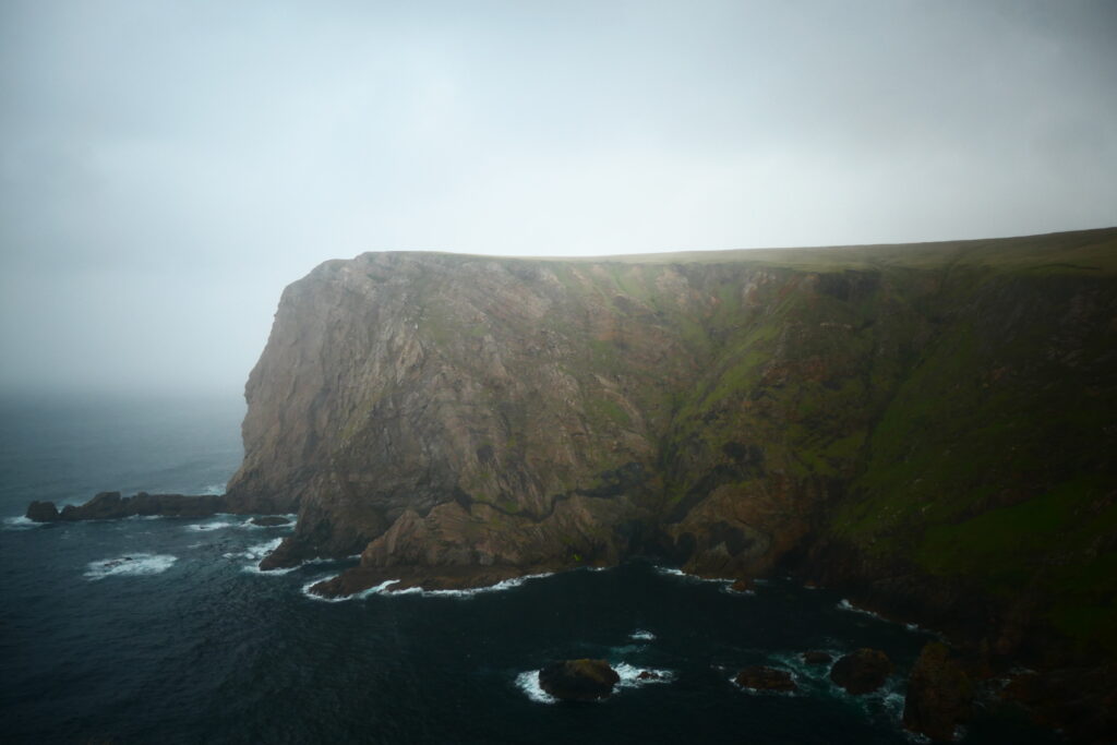
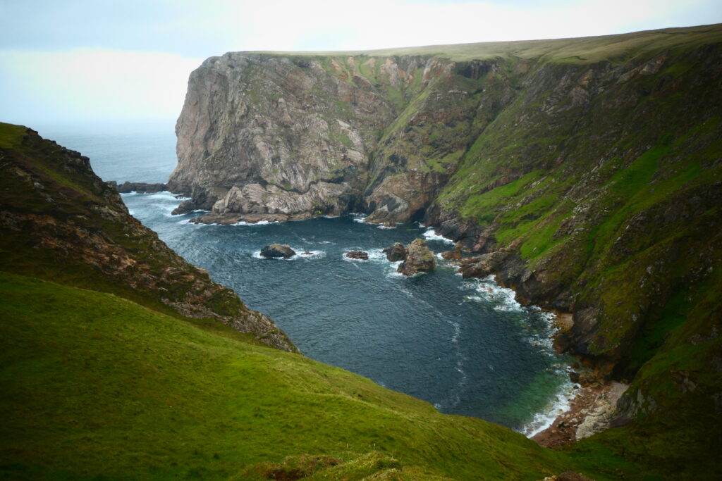
Adrigole, County Cork
Adrigole is a very beautiful village on the magnificent Beara peninsula, south of Glengarriff, in south western Ireland. The village sits on Bantry Bay and is dominated by Hungry Hill, which is the highest mountain in Beara, at 2247 ft (685m) above sea level. The waterfall that flows down the mountain’s east side is named Mare’s Tail waterfall, and is the highest waterfall in Ireland and the UK; you can just see the waterfall near the centre of the picture below.
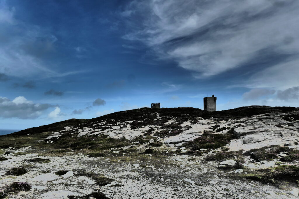
Allihies copper mine trail, County Cork
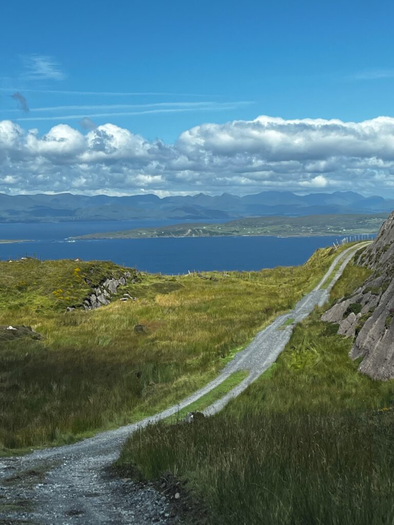
Allihies is located in the south west of the Beara Peninsula, in south western Ireland. At its peak in 1835, the Allihies Mining Company employed 1,600 people, and was the most productive copper mine in Ireland. The trail is mainly a stunning walking route over the mountains through the remains of the 19th-century copper mines, however it can be driven, and provides some spectacular views over the rugged coastline, the Atlantic Ocean, and the surrounding mountains. Some sections of the road have farm gates that require opening and closing, although none are locked.


Allihies copper mine trail
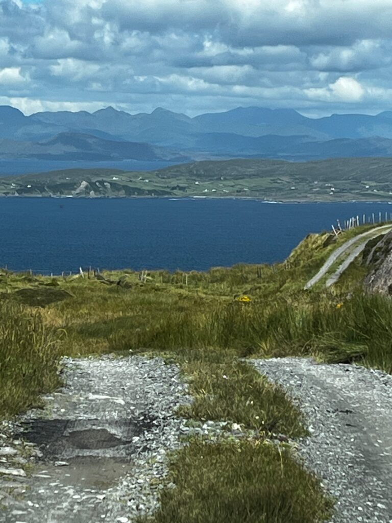
Great views though

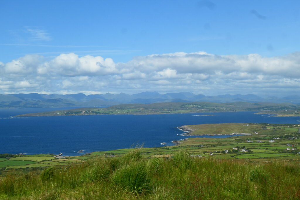


Ardgroom, County Cork
Ardgroom is a colourful, friendly village in the west of the Beara peninsula, near the border with County Kerry, in south west Ireland. The surrounding countryside offers some spectacular views towards the Iveragh Peninsula.
The area has been inhabited for thousands of years, with evidence of prehistoric settlements and ancient monuments, including stone circles and ogham stones, marking its early history. These sites reflect the cultural significance of the area during the Iron Age and early Christian periods. In more recent times, Ardgroom became an agricultural and fishing community, with a focus on small-scale farming and trade. The village’s close proximity to the Atlantic made it an ideal location for maritime activities, while its inland hills were historically used for sheep grazing and farming.

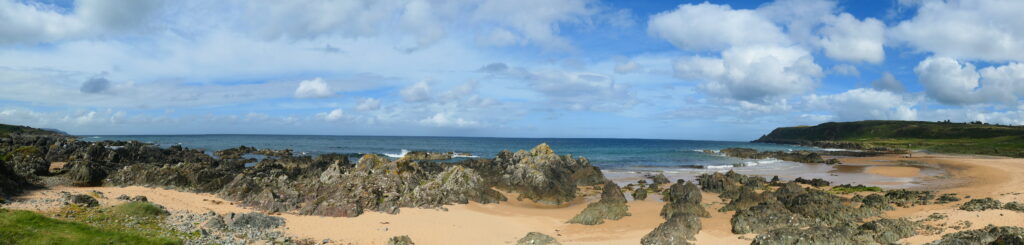
Ballydonegan Bay, County Cork
Ballydonegan Bay is a stunning bay with a gorgeous sandy beach, crystal-clear waters and mountains in the background, located in the south west of the Beara Peninsula, in south western Ireland. It’s totally unspoilt, offers beautiful views and there was literally no-one else around when we were there!

Bantry, County Cork
Bantry is a very pretty little town at the head of Bantry Bay, on the southern edge of the Beara peninsula, in south western Ireland. It’s dominated by a large square, lots of colourful shops and small harbour offering lovely views towards Whiddy Island. The island covers about 1,000 acres (4,000 square m), and has evidence of early Christian settlements and historic buildings, including a former monastery and an old church. In the 20th century, Whiddy Island became an important site for the oil industry, with large oil storage tanks still visible today.
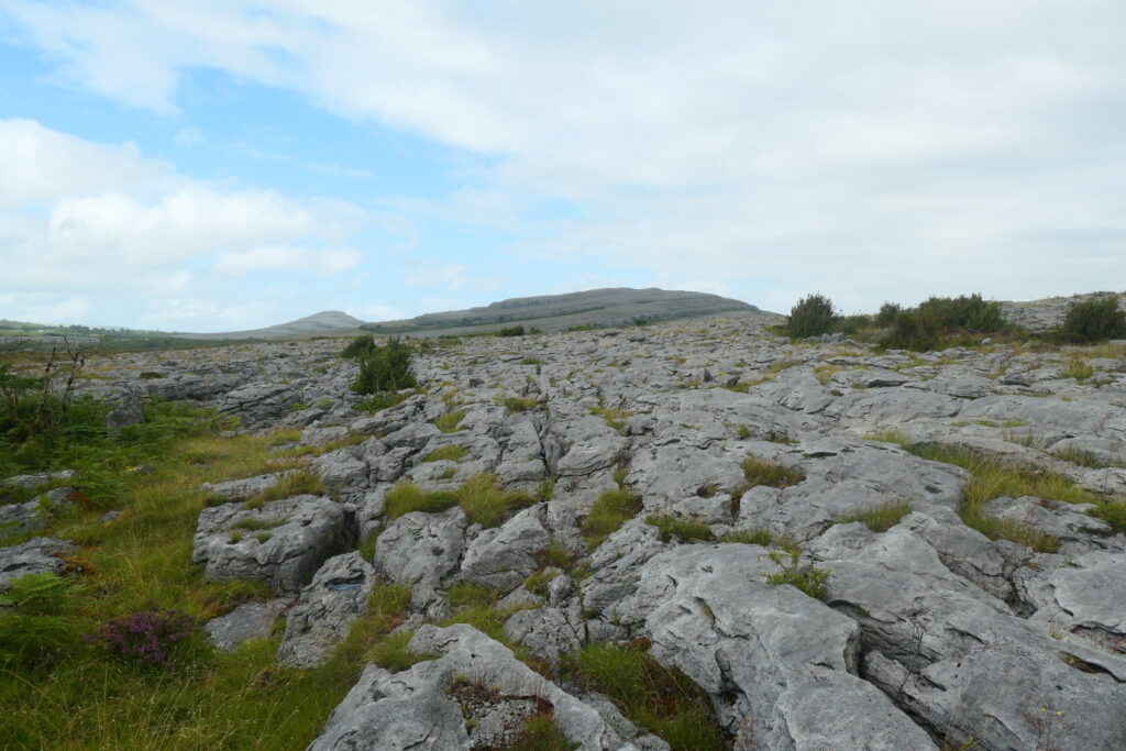
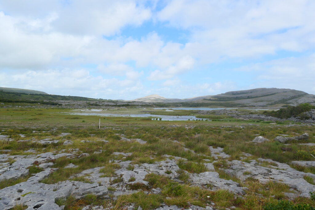
Burren National Park, County Clare
Burren National Park is a small national park, around 1,800 hectares (4,400 acres) in size, located in the west or Ireland, south of Galway. It’s a UNESCO Global Geopark and consists mainly of large areas of limestone rocks, bogs and grassland. The name ‘Burren’ comes from the Irish word Boireann, meaning ‘stony place’, due to its expansive karst landscape, characterised by the limestone pavements, deep crevices, and rocky outcrops. The rugged environment creates an otherworldly appearance, particularly when the cracks in the stone are filled with rare and vibrant wildflowers during the spring and summer months. It’s also an area of archaeological significance, with megalithic tombs, ring forts, and ancient settlements scattered throughout the park, reflecting its long history of human occupation.
Céide Fields, County Mayo
Céide Fields is the most extensive Neolithic site in Ireland and, at 5,500 years old, claims to contain the oldest known field systems anywhere in the world. It’s a vast and ancient landscape of prehistoric stone walls, tombs, and field systems, dating back over 5,000 years. Located in the far west of Ireland, it offers a unique insight into early Irish farming and settlement patterns, and provides breathtaking views of the Atlantic Ocean.
The site is a UNESCO World Heritage nominee, as the area is dotted with stone walls that once delineated fields and enclosures, constructed by early farming communities. The ancient walls are incredibly well-preserved, and much of the site is still being excavated to uncover more of its prehistoric past. The Céide Fields Visitor Centre provides information about the history and significance of the site, including the archaeology, flora, and fauna of the area.

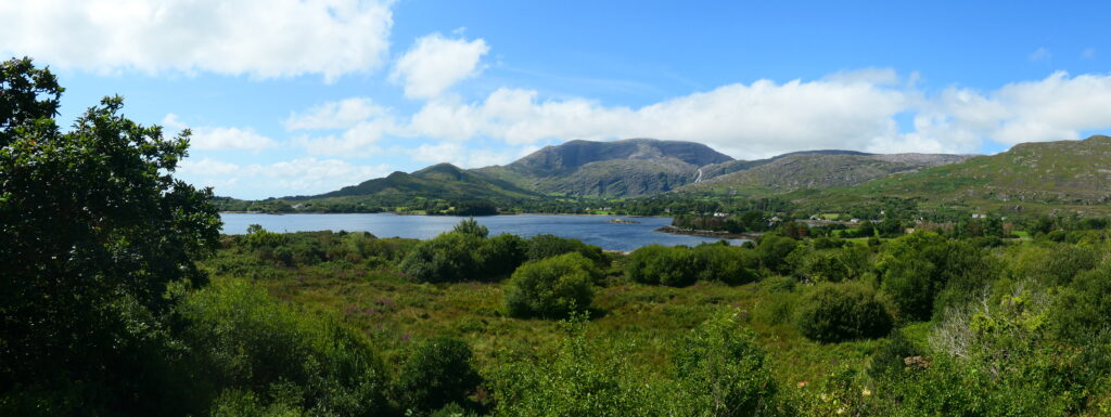
Connemara National Park, County Galway
Connemara National Park is a small national park located in the west of Ireland, west of Galway, and close to Cllifden. It consists of about 2,000 hectares (4,900 acres) of bogs, grasslands, forest and mountains, including the famous Twelve Bens. The mountains form part of the larger range that stretches across the western side of the country, offering some of the most stunning landscapes in Ireland. The peaks of the Twelve Bens vary in height, with the highest being Benbaun, at 2,392 ft (729 meters) above sea level, which is the tallest mountain in the range. The mountains are composed of quartzite rock, which gives them their distinctive appearance, especially when viewed from a distance.
Hiking the Twelve Bens is a challenging but rewarding experience. The trails are well-regarded for offering spectacular views of the surrounding landscape, including lakes, valleys, and the coastline of Connemara. The mountains are also home to diverse wildlife, such as red deer and various bird species, making the range an important natural habitat as well as a scenic wonder. Unfortunately for us, it’s one of the few places we’ve been that hasn’t been sunny!

Coomanaspig, County Kerry
Coomanaspig is a tiny hamlet in the south west of the Iveragh Peninsula, in far south western Ireland. The pass is famous for its spectacular scenery, with views of the Slieve Mish Mountains to the south and the majestic peaks of the Macgillycuddy’s Reeks, including Carrauntoohil, Ireland’s highest mountain, to the north. The name ‘Coomanaspig’ comes from the Irish Cúm an Aspaig, meaning ‘the hollow of the little goat’, reflecting its rugged terrain, which was historically home to sheep and goats. Coomanaspig lies on of the famous Ring of Kerry route, and offers a serene and awe-inspiring experience, making it a must-see spot for anyone exploring the natural beauty of County Kerry.
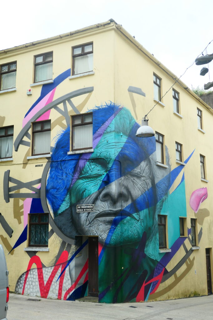
Cork, County Cork
Cork is a lovely, friendly city in the south of Ireland. The city is a cultural hotspot and whilst we were there there was a pride festival taking place. Although the weather was inclement that day, they were definitely trying to make the most of the festivities 🙂
Cork City, the county’s capital, is a lively and historic urban centre known for its cobbled streets and beautiful riverfront along the River Lee. Cork is also rich in history, with ancient sites like Blarney Castle, where you can kiss the famous Blarney Stone for a legendary gift of eloquence.
The city was founded by the Vikings around 915 AD, and you can still spot traces of that Viking heritage if you know where to look. It grew rapidly as a trading hub, with its strategic location along the River Lee allowing for easy access to both the sea and inland Ireland. Over the centuries, Cork saw its fair share of invasions and battles, including the Norman conquest and the English Civil War. In the 17th century, the city became a key center for rebellion during the Cromwellian period. The 19th century was a time of industrial growth, but it was also marked by hardship, especially during the Great Famine, which left deep scars on the city. Yet, Cork has always bounced back, reinventing itself with a strong sense of local pride.


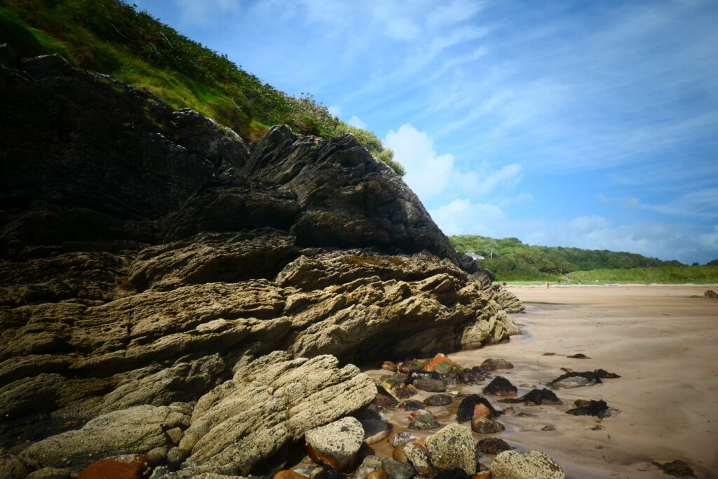
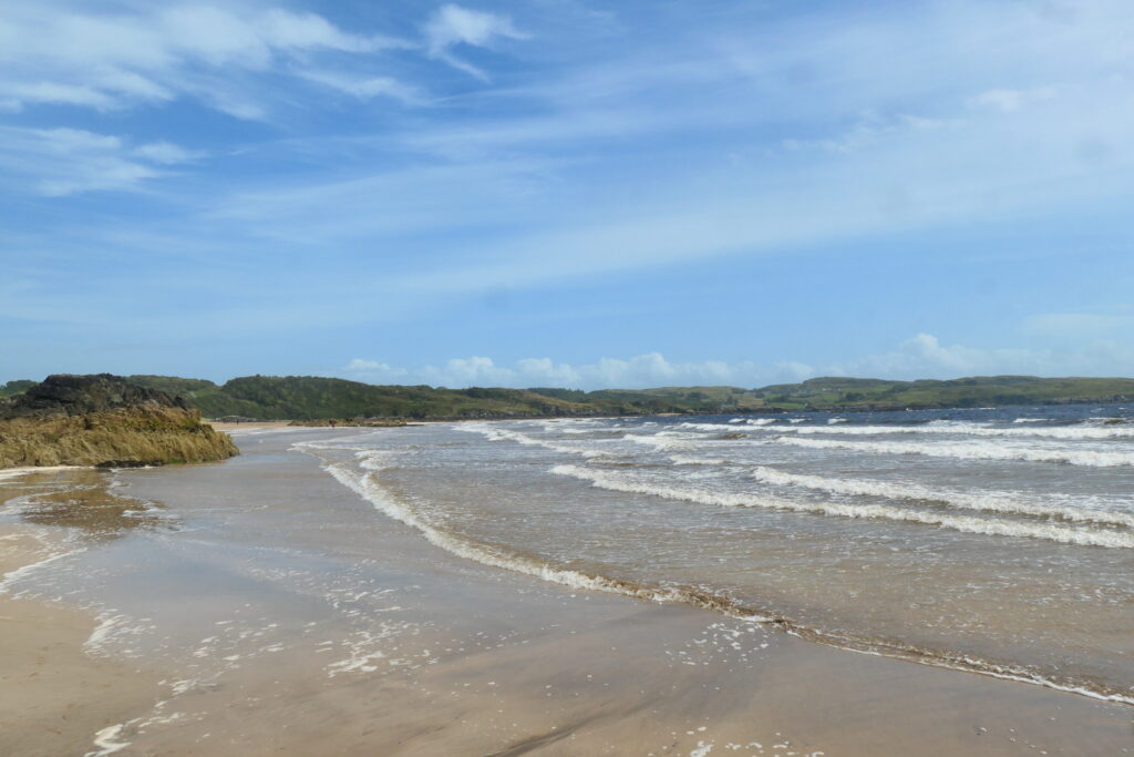
Curracloe Beach, County Wexford
Curracloe Beach is a lovely long sandy beach near to the county town of Wexford, in south eastern Ireland. Due to its similarity to Omaha beach in Normandy, France, it was used for the filming of the D-Day sequence in the film Saving Private Ryan.
We loved how peaceful it felt, with the sound of the waves crashing and the wind blowing through the grasses. The beach is wild and unspoiled, and there’s something incredibly calming about walking along the shoreline, whether it’s a sunny day or when the clouds roll in and the sky turns dramatic. It’s also part of the Curracloe Strand, a nature reserve, so there’s a lot of wildlife to spot, from birds to seals, making it a great place for nature lovers. If you’re ever in County Wexford, take a look, it’s a great place to visit!

Dirreencallaugh, County Kerry
Dirreencallaugh is a tiny, picturesque hamlet on Kenmare Bay in the Bearra peninsula, in south western Ireland. The name ‘Dirreencallaugh’ roughly translates to something like ‘the oak wood by the stream or ‘the little oak grove near the watercourse’, which fits the natural landscape around the area. The landscape is lovely, with views of rolling hills, serene lakes, and lush green valleys. It’s the kind of place where you can properly disconnect and enjoy the natural surroundings. o h, and there’s a wildlife cruise boat there, from which you can see seals and other creatures 🙂

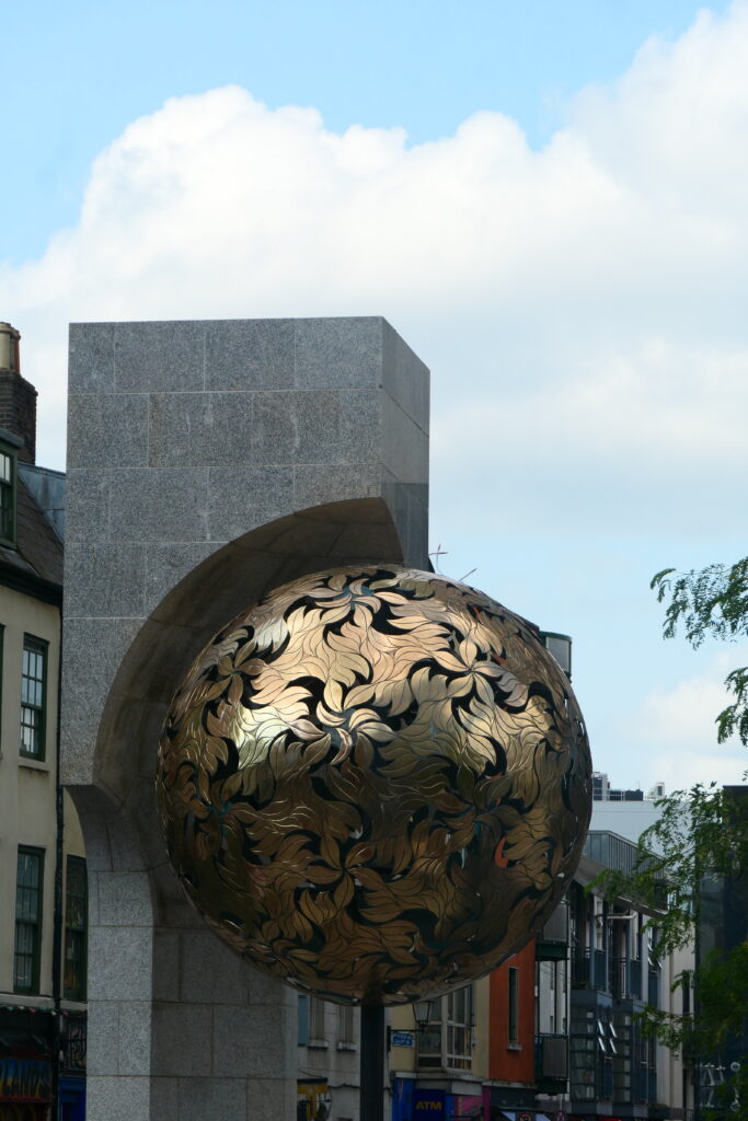
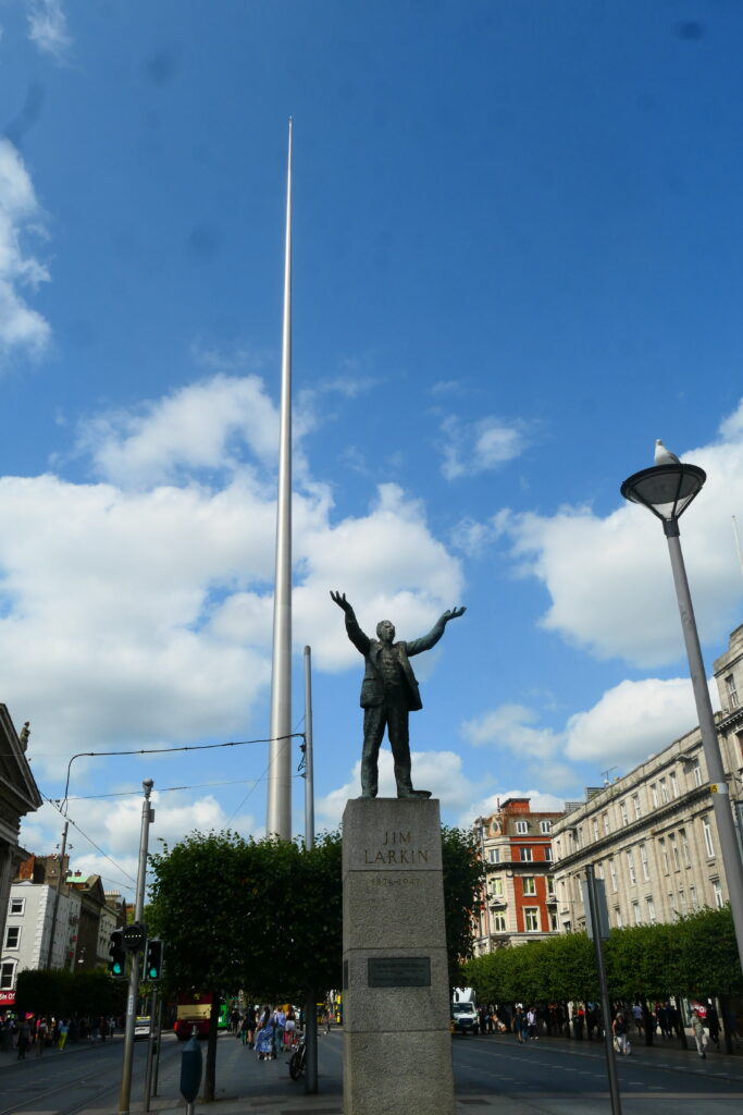
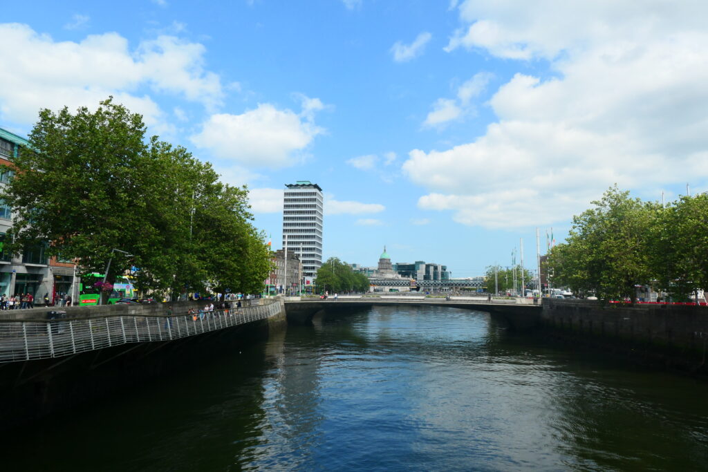
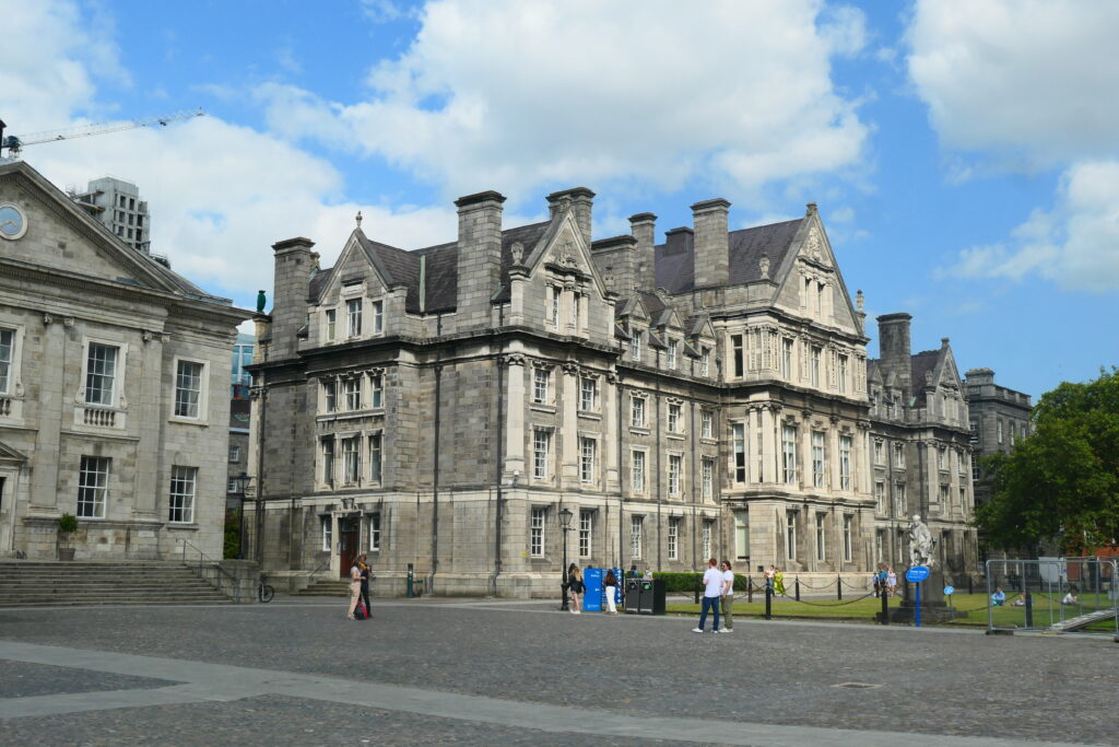
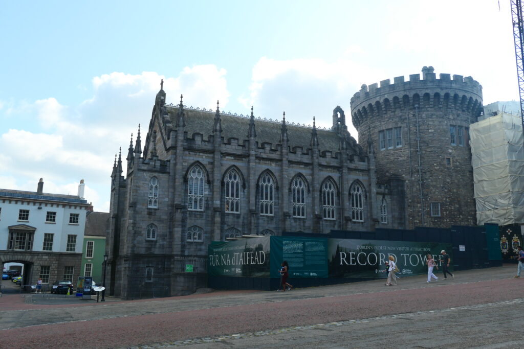
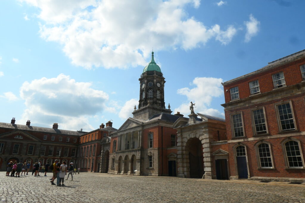
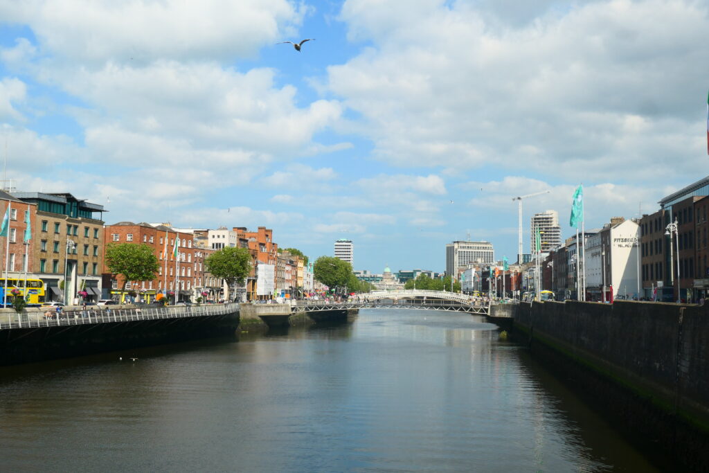
Dublin
Dublin is a city that feels like home in so many ways. There’s something about the energy there; whether it’s the lively streets full of people, the rich history around every corner, or the charm of the old Georgian buildings that line the streets; that makes it feel both modern and timeless at once.
As the capital of the Republic of Ireland, the wider the metropolitan area has a population of almost 1.3 million people (2022), but it never feels too busy. There are four universities in the city, and along with the massive amount of tourists that visit the city throughout the year, there’s a vibrant, youthful and friendly atmosphere.
You can wander through the cobbled streets of Temple Bar and be swept up in the music and art, or take a stroll along the River Liffey, enjoying the views of the bridges and the city’s skyline. And then there’s the history. From Dublin Castle to Trinity College, the Book of Kells to Kilmainham Gaol, the city is steeped in stories that span centuries.
We also particularly loved exploring its green spaces like St. Stephen’s Green, or the beautiful botanic gardens. Of course, no visit to Dublin is complete without experiencing its famous pub culture. Whether it’s a pint at a bar with a view over the city or chatting with locals in a cozy pub in the heart of the city, the warmth and friendliness of Dubliners always make you feel welcome.


botanic gardens, Dublin

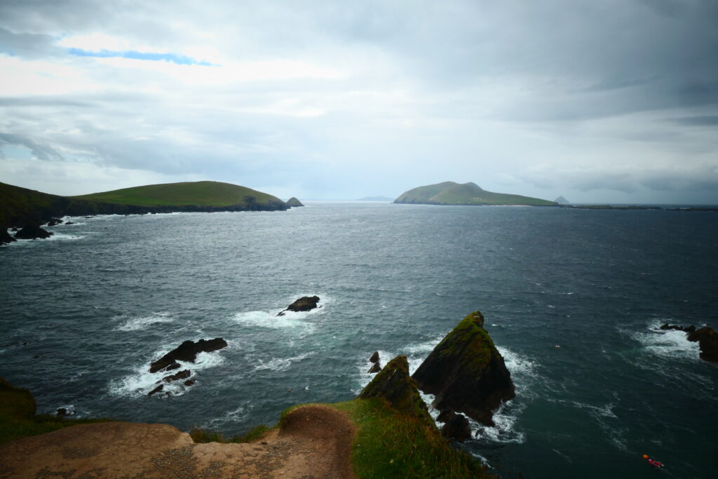
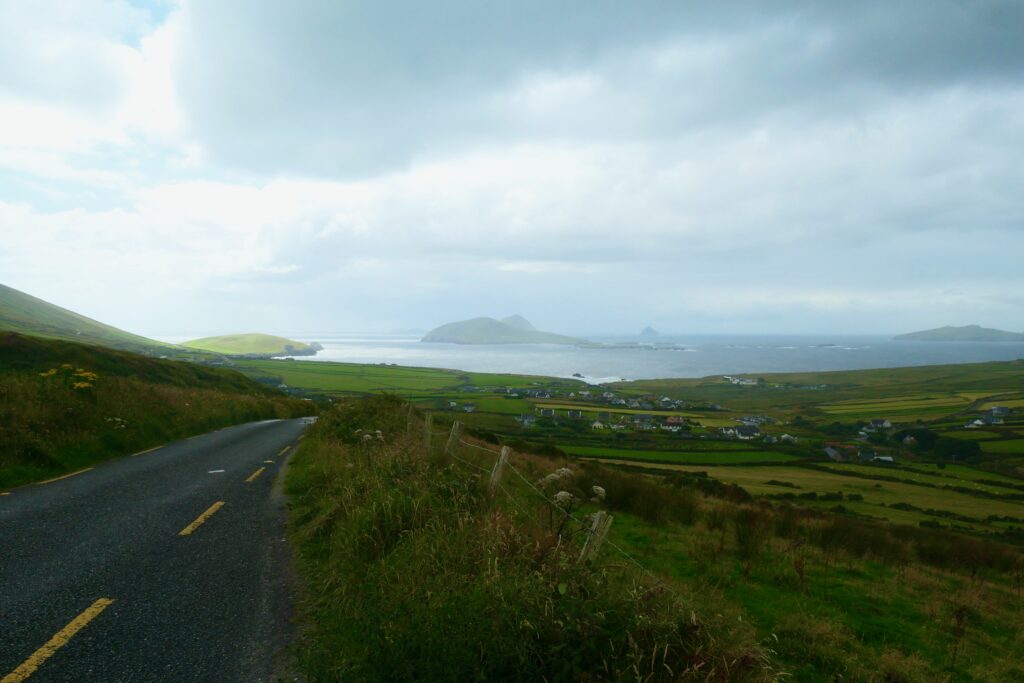
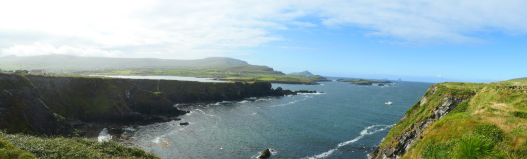
Dun Chaoin, County Kerry
Dun Chaoin (pronounced Dun Kwee-in) is the most westerly settlement of Ireland and of Eurasia, excluding Iceland. It’s located in the far west of the Dingle peninsula, and offers excellent views, in particular over the Blasket islands. It can get very windy in this remote region and much of the land is quite unstable.
The area was once home to a thriving community of native Irish speakers, and you can still hear the Irish language spoken by locals today. The village is closely tied to the history of the Blasket Islands, which were inhabited until the 1950s and have since become famous for their literature and connection to the Irish cultural revival.
One of the most iconic landmarks in Dun Chaoin is the Dun Chaoin Pier, a picturesque spot that provides access to the Blasket Islands. The pier is often featured in photographs, especially at sunset, when the dramatic cliffs and ocean views are breathtaking. The village is also located along the Dingle Way, a popular walking trail that circles the peninsula.
from Dun Chaoin

Farraniaragh, County Kerry
Farraniaragh is a tiny hamlet in the south of the Iveragh Peninsula, in south west Ireland, overlooking Scariff and Deenish islands and the south west of Beara peninsula. It feels like one of those hidden treasures that only locals truly know about. The whole area has an authentic, rural vibe where time feels like it slows down. It’s the kind of place where you should take a break, completely disconnect, and soak in the unspoiled natural beauty that defines County Kerry.

Fintragh Bay, County Donegal
Fintragh Bay is a very pretty ½ mile (1 km) long sandy beach in the north west of Ireland on the Wild Atlantic Way, near Killybegs. The bay is known for its stunning natural beauty, with clear waters, sandy beaches, and the surrounding rugged cliffs.
Killybegs is a working town with a laid-back, welcoming vibe. Historically, it grew around its fishing industry, with large trawlers and fishing boats operating in the bay. Over time, the town has developed into a hub for seafood processing, and today it remains a key player in Ireland’s fishing sector. You can still see the bustle of activity at the harbor, where fishing boats are docked and unloading their catch.

Foilhommerum Bay, Valentia Island, County Kerry
Foilhommerum Bay is a stunning bay located in the south west of the Iveragh Peninsula on Valentia Island, in far south western Ireland. The whole area is dotted with small farms and traditional stone cottages, and as you walk around, you can’t help but feel like you’re stepping back in time.
It is also the site of the first transatlantic telegraph communication cable, from Foilhommerum Bay to Heart’s Content, Newfoundland. Completed in 1866, it meant, for the first time in history, that you could send messages across the Atlantic Ocean, forever changing global communication.
The cable itself spanned over 2,000 miles (3,200 km) of ocean, enabling telegraph messages to be sent between Europe and North America in just minutes, as opposed to the days or weeks it took by ship. The first message sent through the cable was from Queen Victoria to U.S. President Andrew Johnson, demonstrating the significance of the achievement.
Fort Dunree, County Donegal
Built during the Napoleonic Wars in the early 19th century, Fort Dunree was built on a promontory away from the mainland. It’s located in the far north of Ireland, on the Inishowen peninsula, overlooking the beautiful Lough Swilly, not far from Malin Head. During World War I and World War II, Fort Dunree was used by the British military, and it housed various coastal artillery guns and radar equipment. Today, it’s a fascinating heritage site, with a well-preserved collection of military structures, including bunkers, gun emplacements, and the original fortifications.
The fort is also home to a wildlife reserve, with birds such as puffins and seals often spotted in the waters around the cliffs. It’s very well preserved and is a great place to visit.
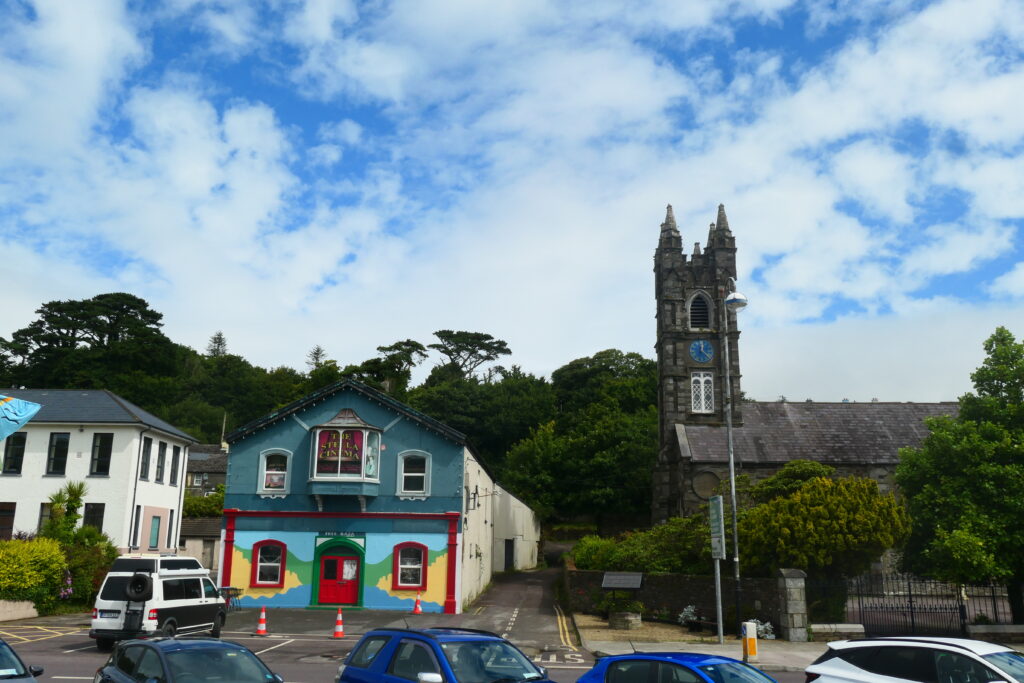
Glencolumbkille, County Donegal
Glencolumbkille is a lovely little village in the north west of Ireland. Many people speak Irish in the area and there is a popular Irish language school in Glencolumbkille. The village lies at the foot of the spectacular Slieve League mountains, offering breathtaking views of the surrounding landscape, including dramatic cliffs, rolling hills, and the wild Atlantic Ocean.
The village is also home to the Glencolumbkille Folk Village, a unique open-air museum that showcases traditional Irish life from centuries past. It consists of a collection of restored cottages, a schoolhouse, and other historical buildings, giving you a glimpse into the everyday lives of past generations. The village also has a strong arts and crafts scene, with many local artists and craftmakers producing beautiful works inspired by the stunning surroundings. You’ll find galleries and workshops in and around Glencolumbkille, offering a chance to pick up a piece of local artistry.
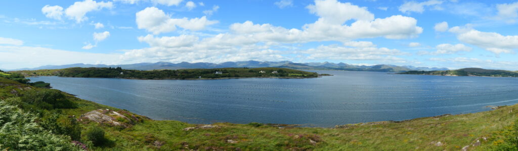
Glengarriff, County Cork
Glengarriff is a great little town on the Ring of Beara, in south western Ireland, at the edge of Bantry Bay, with the majestic Caha Mountains towering in the background. There are many cafés and restaurants, and as such it’s a very popular stop-off point for tourists. There is a beautiful little hidden harbour, with lots of lovely walks, called the Glengarriff Blue Pool.
The Blue Pool is fed by freshwater streams that flow down from the surrounding Caha Mountains, and its waters have a distinctive blue-green color, which gives the pool its name. Warmed by the Atlantic Gulf stream, it’s covered by lush Atlantic Oak woodlands and overlooks several islands, including Garinish Island. This island is accessible by boat, and is renowned for its exquisite Italianate gardens, which were created in the early 20th century and feature a stunning collection of plants and trees from around the world.


Glengesh Pass, County Donegal
Glengesh pass travels through the beautiful Croknamurrin mountains area, in north western Ireland. It is part of the Wild Atlantic Way and connects Glencolmcille to Ardara via the R230 road. One of the most scenic drives in the country, the pass is nestled in the Slieve Tooey mountain range, with steep, winding roads that wind through lush green landscapes and rugged terrain.

Gleninchaquin Park, County Kerry
Gleninchaquin Park is a beautiful scenic area near to kenmore on the Beara peninsula, in south west Ireland. The park is set in a picturesque valley surrounded by the rugged Caha Mountains, located near the village of Kenmare, and is a privately owned park that has some of the most breathtaking landscapes on the Ring of Beara. One of the main highlights is the Gleninchaquin Waterfall that tumbles down from a height of 395 ft (120 m), creating a breathtaking sight as the water flows into the valley below.
There are many walks in the area for keen hikers, although the land can be very boggy, so bring decent footwear! The main trail is the Gleninchaquin Loop Walk, which is a popular route that takes you around the valley, passing the waterfall, along peaceful streams and through the forests.

Gour, County Cork
Gour is a remote hamlet located in the south west of the Beara peninsula, in south west Ireland. Nestled along the Bandon River, it offers lovely long range views towards the coast and the mountains. It’s close to the 17th century town of Bandon, which was founded by Cromwellian settlers, making it one of the oldest towns in County Cork. It is often referred to as the ‘Gateway to West Cork’, as it serves as a key starting point for anyone exploring the scenic coastal routes of the Wild Atlantic Way.
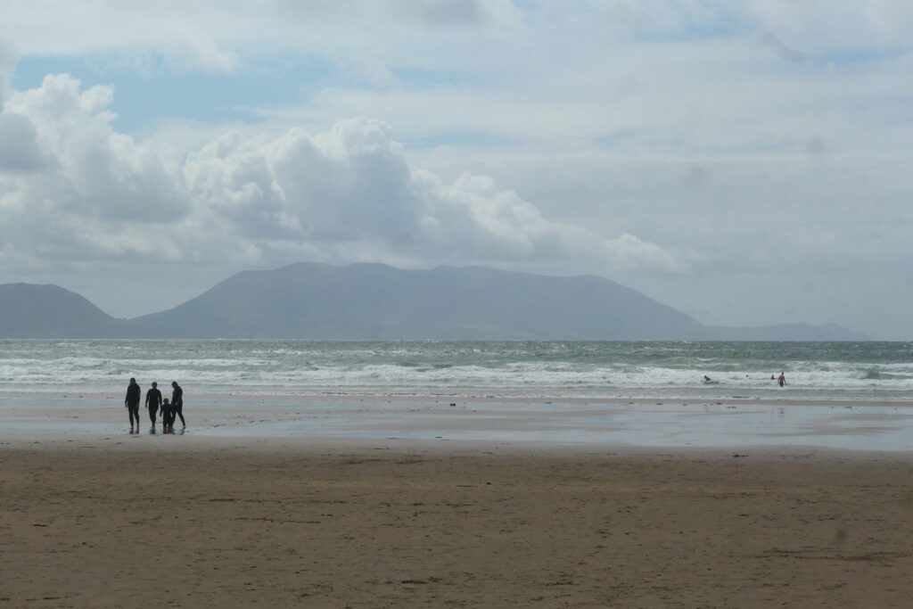
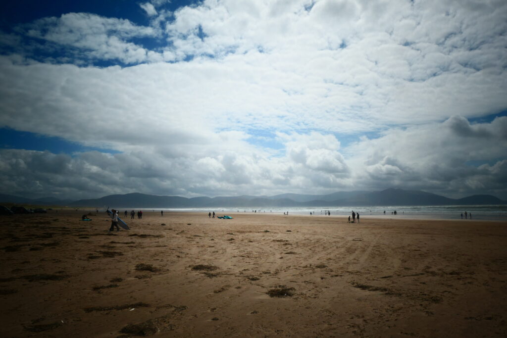
Inch beach, County Kerry
Inch beach is a lovely sand dune 3 miles (5 km) in length that stretches out into Castlemaine harbour. It’s located on the south side of the Dingle peninsula, in south western Ireland. Its shallow waters and consistent waves make it ideal for surfing, kite surfing, windsurfing and swimming. It was also famously used as a filming location for the 1970 movie Ryan’s Daughter. There’s ample parking available right next to the beach, and there are also a few local cafés and places to grab a bite.

Kilgalligan, County Mayo
Kilgalligan is a lovely village in remote north west of Ireland … “next stop America” as I was told 🙂 People are friendly and the views are spectacular!
The area offers sweeping views of the wild Atlantic Ocean, with dramatic cliffs and rocky shorelines that add to its rugged charm. The windswept landscape is particularly popular for birdwatching, with seabirds and migratory species often spotted along the cliffs and shore. There’s also the closeby Ballycroy National Park, a protected wilderness area known for its peat bogs, heathland, and rich wildlife.
Kilgalligan is also an area that speaks to Ireland’s deep history and cultural heritage, with many of the local farms and fishermen’s cottages built in the traditional Irish style, creating a peaceful and authentic rural setting.
Kilkinnikin West Beach, County Cork
Kilkinnikin West Beach is a remote beach area in the south west of the Beara peninsula, in south west Ireland, near to Lambs Head. The whole area offers some of the best panoramic views on the Mizen Peninsula. The beach itself is small and secluded, with golden sand backed by lush dunes, creating a great place for a relaxing day by the sea.
There is a lovely early 19th century watch tower in the area, at Black Ball Head, that was built in case of a French invasion during the Napoleonic Wars. There were 81 such towers built around the coast of Ireland for this purpose, in order to signal Dublin.
Kinsale, County Cork
Kinsale is an enchanting little town on the south west coast of Ireland. Nestled at the mouth of the Bandon River, Kinsale is often referred to as the ‘Gourmet Capital of Ireland’ due to its excellent selection of restaurants, cafés, and seafood eateries.
The town’s history dates back to medieval times and it has played an important role in Irish and British history. Kinsale was the site of the famous Battle of Kinsale in 1601, a key event in the Nine Years’ War, where Irish forces were defeated by the English. The town is also home to Charles Fort, a well preserved star shaped fort built in the late 1600s to protect the harbour from naval attacks.
The town is close to some stunning natural sites, including the Old Head of Kinsale, a dramatic headland with spectacular cliffs and a lighthouse. Additionally, the Kinsale Coastal Walk offers scenic routes along the cliffs, providing beautiful views of the Atlantic Ocean and the countryside.
With its colourful houses, pretty lanes, lovely river views and its bustling cafés, it’s definitely worth a visit.

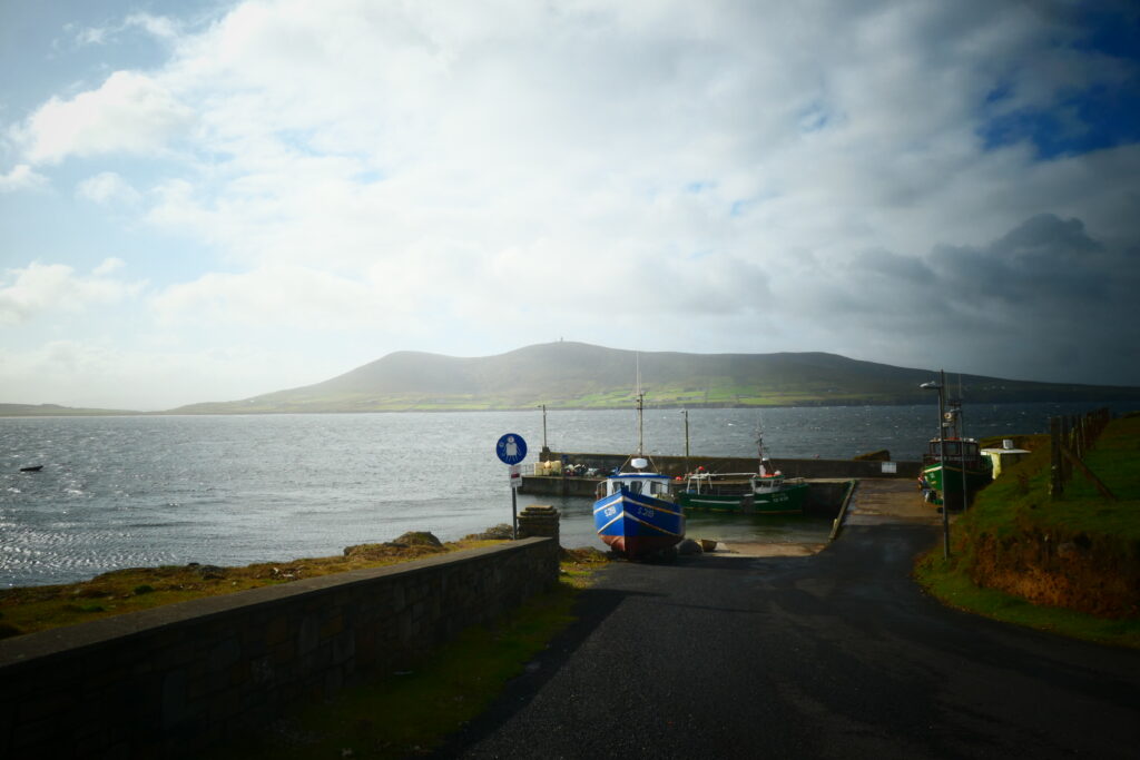
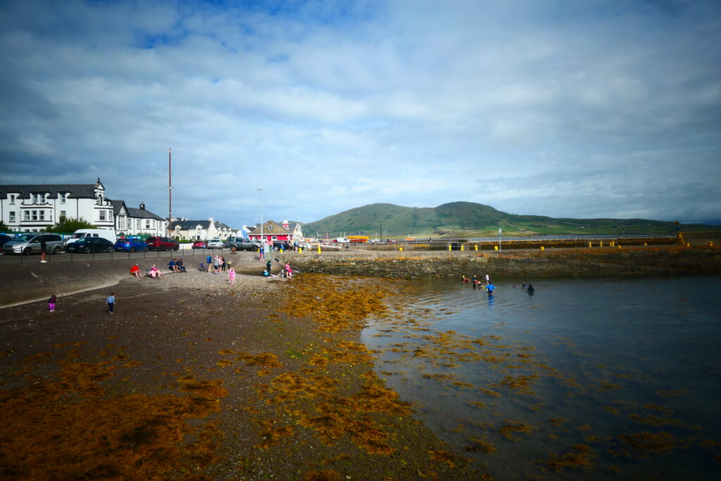
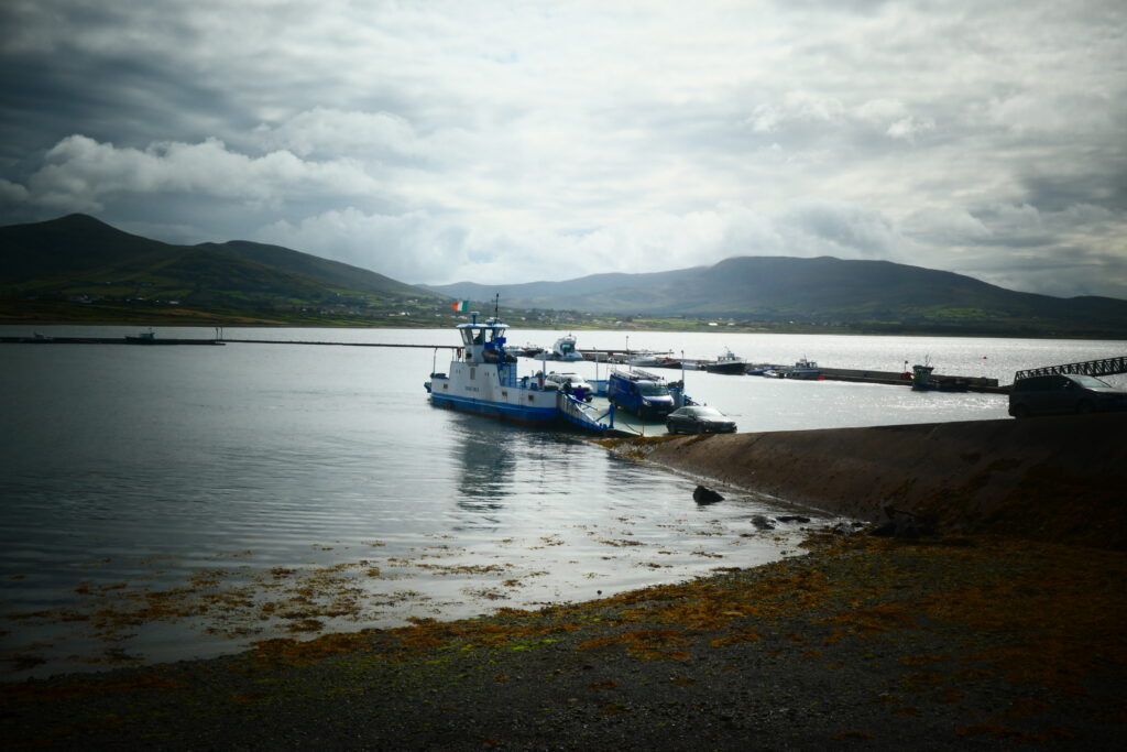
Knight’s Town, Valentia Island, County Kerry
Knight’s Town is a lovely little village located in the south west of the Iveragh Peninsula on Valentia Island, in far south western Ireland. It serves as the main settlement on Valentia Island and has a quaint, traditional Irish village feel, with colourful cottages, a few local shops, cafés and pubs. Valentia Island is famous for its stunning landscapes, and Knight’s Town is no exception.
There is also a small ferry that travels between Knight’s Town and Reenard Point on the mainland.

Letterfrack, County Galway
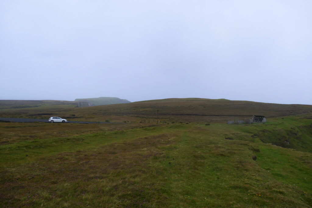
Letterfrack is a small hamlet that sits on the edge of Connemara National Park in the west of Ireland, close to Clifden. The ealy morning mist gave it a spooky, haunted atmosphere when we were there 🙂
Connemara National Park is a stunning natural reserve covering about 5,000 acres (2,000 hectares) of rugged, diverse landscapes. It is one of Ireland’s most scenic and unspoiled natural areas. One of the park’s most notable features is Diamond Hill, which Letterfrack sits at the base of, and which stands at 1,450 ft (442 m) above sea level. The summit offers panoramic views of the surrounding area, including the Twelve Bens, the Tully Mountains, Ballynakill Harbour, and the Atlantic Ocean. There are well maintained trails that lead to the top, with varying levels of difficulty, making it accessible to both casual walkers and more experienced hikers.


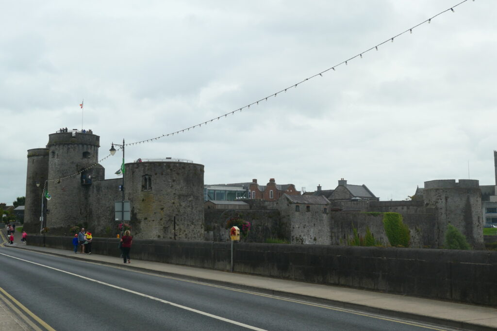
Limerick, County Limerick
Limerick is a small city in the mid west of Ireland. It sits on the River Shannon, and much of the city is actually on the island of King’s Island. Limerick is one of Ireland’s oldest cities, with a history stretching back over 1,000 years, and there’s a great Norman castle that’s well worth a visit called King John’s Castle, built in the year 1200.
The impressive St. Mary’s Cathedral, one of the oldest buildings in the city, dating back to the 12th century, is also worth a visit, as is the Milk Market, one of Ireland’s oldest food markets. Limerick is, of course, also a modern, bustling city with decent shops and cafés.
Lomanagh Holy Well, County Kerry
Lomanagh Holy Well’s were once used by Catholics for devotional purposes on feast days. This well is located near to Kenmare on the Iveragh Peninsula, in south western Ireland.
Holy wells like Lomanagh have been part of Irish heritage for centuries, often linked to both pre-Christian and Christian traditions. People visit these wells seeking spiritual blessings, healing, and protection. The practice of “ragging,” where visitors leave offerings such as cloth, rosary beads, coins, and other tokens tied to nearby trees, is common at Lomanagh Holy Well. These offerings are believed to invoke blessings and healing powers.

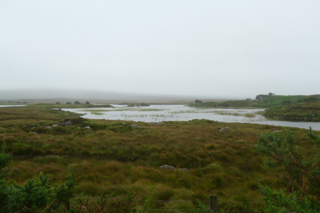
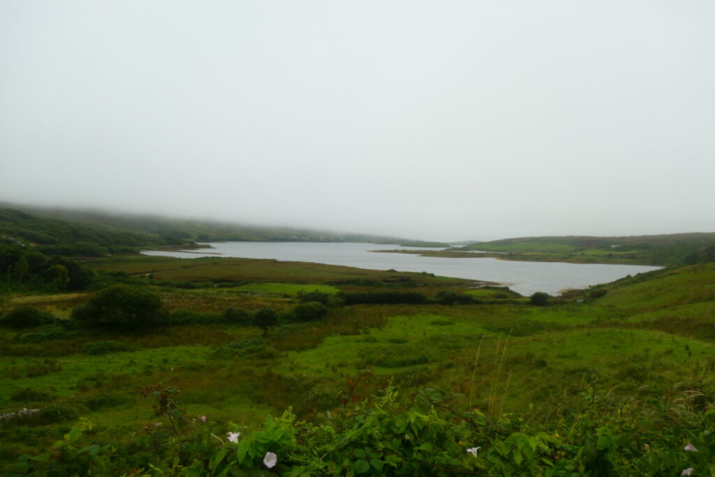
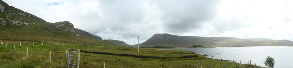
Lough Barra, County Donegal
Lough Barra is a scenic freshwater lake nestled in the Gweebarra River Valley, located in the north west of Ireland on the edge of Glenveagh National Park. The lake is approximately 1 mile (1½ km) in length and ½ mile (1 km) in width, covering an area of ¼ square miles (⅔ square km). It is surrounded by over 430 acres (176 hectares) of the Lough Barra Bog, a special area for protected birds and bogland. It’s fed by the Barra River, which enters the lake from the north, and drains southward into the Gweebarra River. The surrounding landscape is characterized by rugged terrain, making Lough Barra a lovely, quiet location.
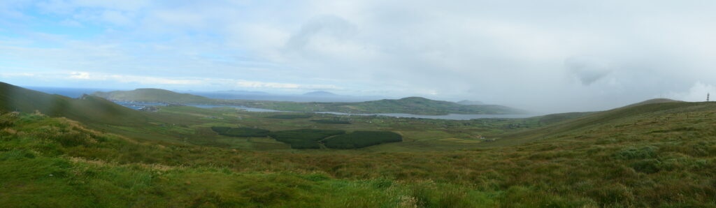
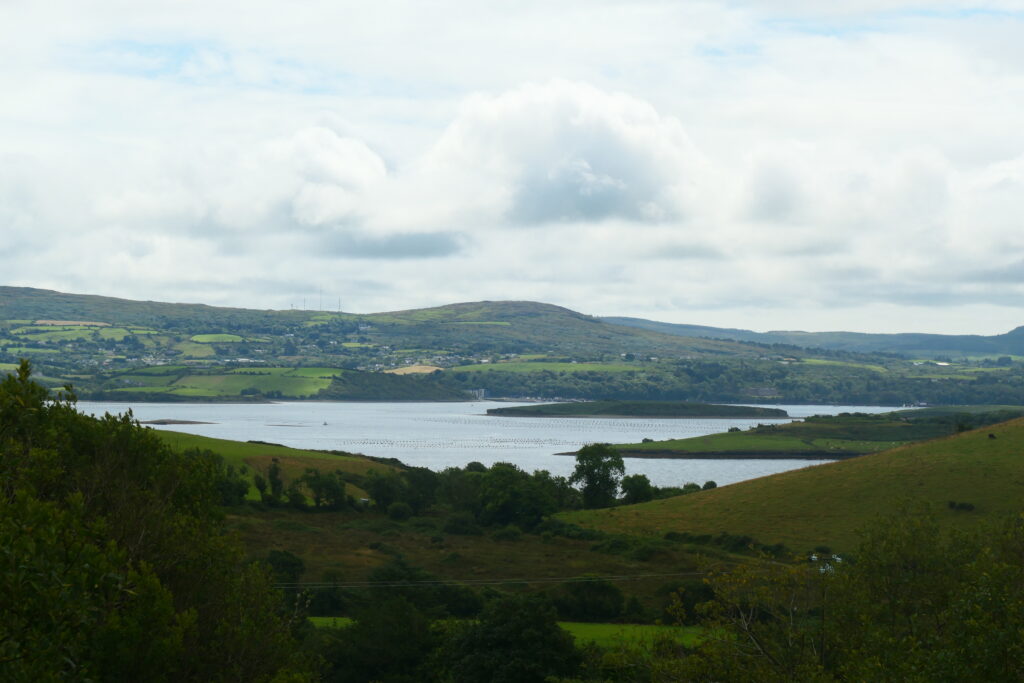
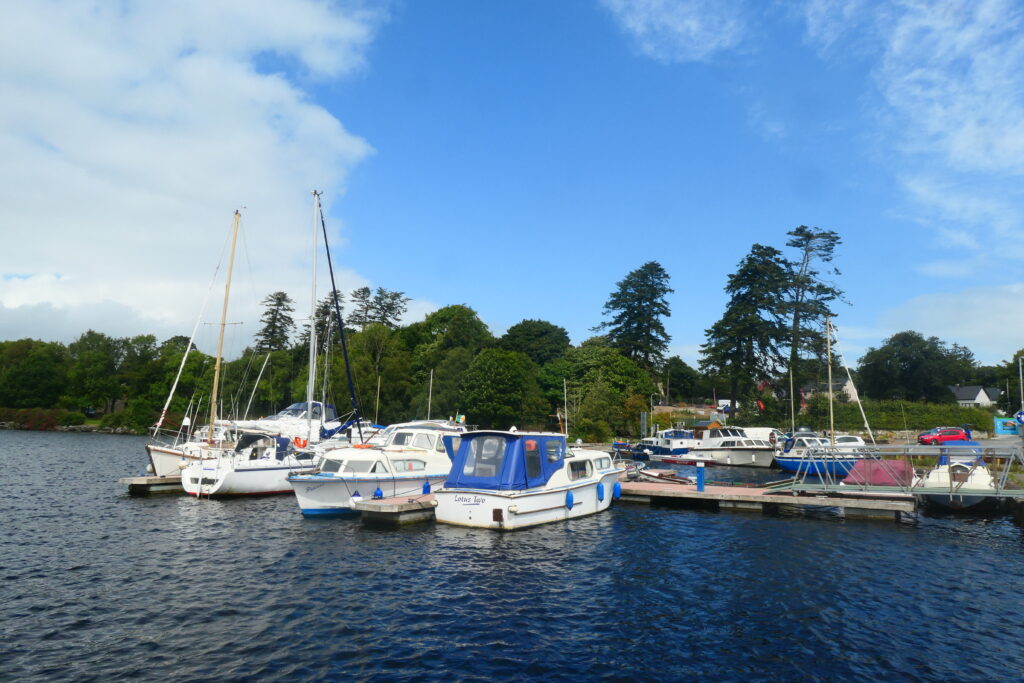
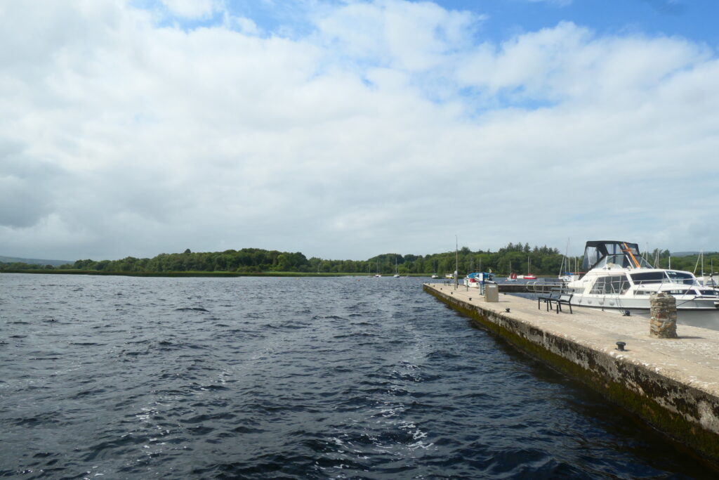
Lough Derg
Lough Derg is the second biggest lake in the Republic of Ireland, and the third biggest on the island of Ireland. It sits across the counties of Clare, Galway, and Tipperary and is located quite close to Limerick, in the mid west of the country. There are many harbours and marinas, including at Mountshannon in County Clare.
Historically, Lough Derg was an essential waterway, facilitating trade and transportation in Ireland, especially during the 19th century when it served as a vital route for goods traveling between Limerick and Dublin. Today, it remains a popular spot for recreational activities such as boating, fishing and sailing.
It stretches approximately 24 miles (39 km) in length, and is particularly renowned for its scenic beauty, with lush, rolling hills surrounding its shores and picturesque towns nestled along its banks. There’s also a walk called the Lough Derg Way, which is a scenic trail that spans approximately 43 miles (70 km).

Malin Head, County Donegal
Malin Head is is the northernmost point of mainland Ireland. It’s located on the Inishowen peninsula and is very popular with tourists. The landscape features towering cliffs, vast stretches of the Atlantic Ocean, and unique rock formations, creating a truly wild and unspoiled environment. AT the peak there’s a meteorological station providing weather data.
During World War II, large signs spelling ‘ÉIRE’ were placed on the headland to indicate Ireland’s neutral status to aircraft flying overhead. More recently, several scenes from Star Wars: The Last Jedi were filmed at Malin Head.
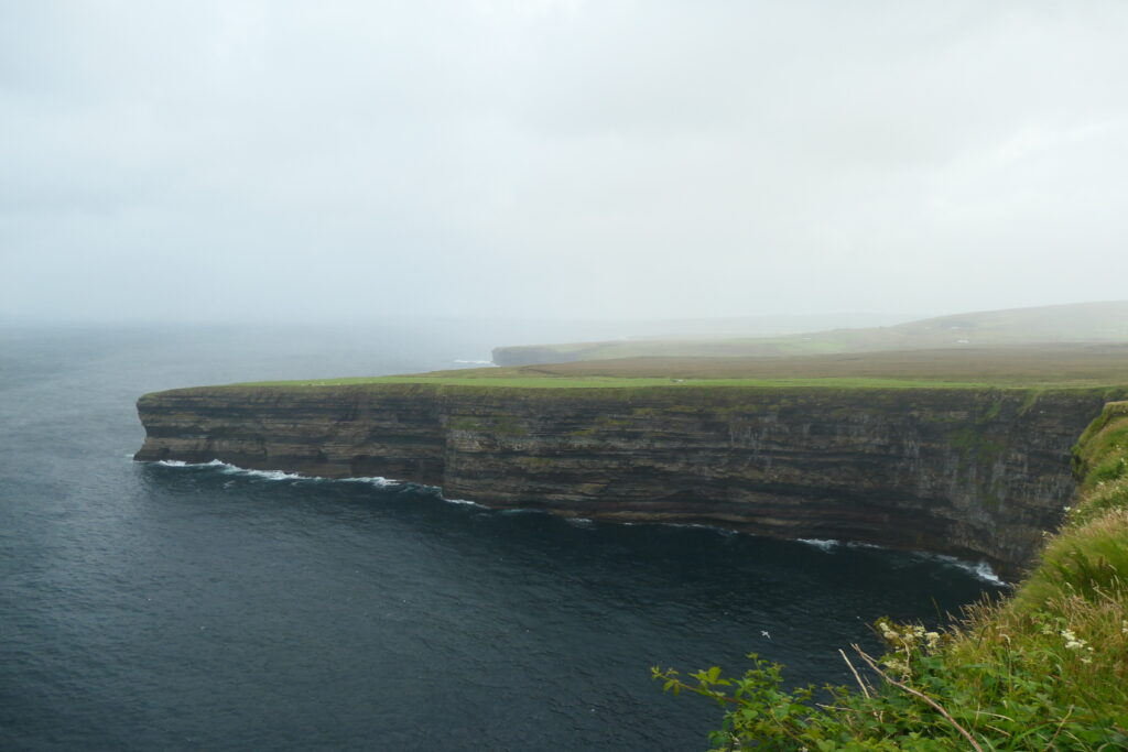
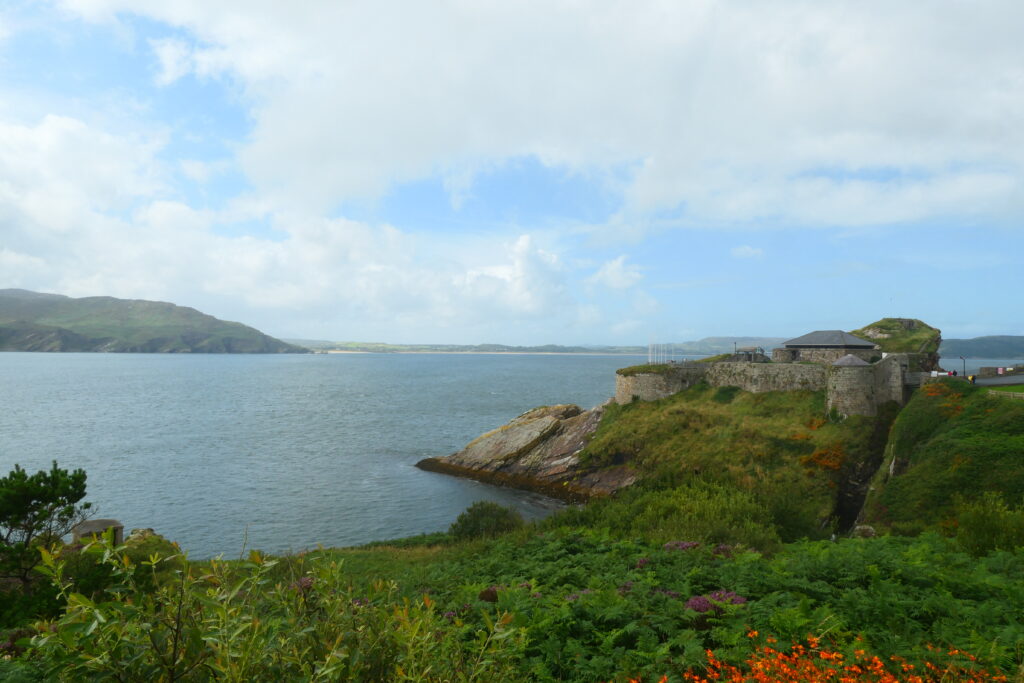
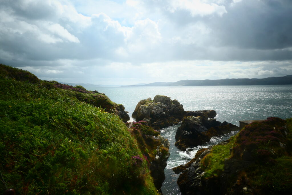
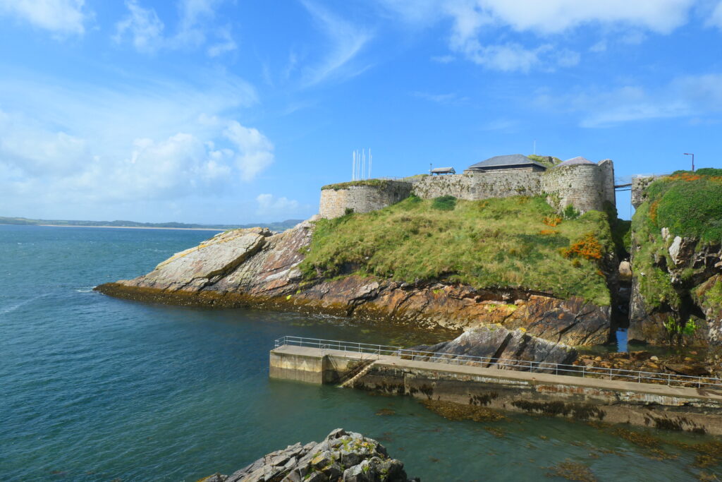
Mizen Head, County Cork
Mizen Head is known as the most southerly place in Ireland. The cliffs are high and the tourists are many. The views approaching and leaving the head are pretty spectacular.
At the heart of Mizen Head is the Mizen Head Signal Station, a former lighthouse and watch station dating back to the 19th century. The station, which is now a visitor center, played a crucial role in maritime navigation and safety, guiding ships safely along the treacherous coastline. The Signal Station is accessible by a bridge that spans across a deep ravine.

Portronan, County Donegal
Portronan is a small hamlet near to Malin Head on the Inishowen peninsula in the far north of Ireland. The bay is secluded and not well known, but is spectacular! The landscape around Portronan is dramatic, with cliffs, rolling hills, and serene beaches.
The area is also known for its traditional Irish cottages, some of which have been renovated, and the small village atmosphere it offers. Due to its position along the northern coast, Portronan is a quiet, less commercialised area, and there are some lovely coastal paths, which provide an opportunity for birdwatching, especially during the migratory seasons.
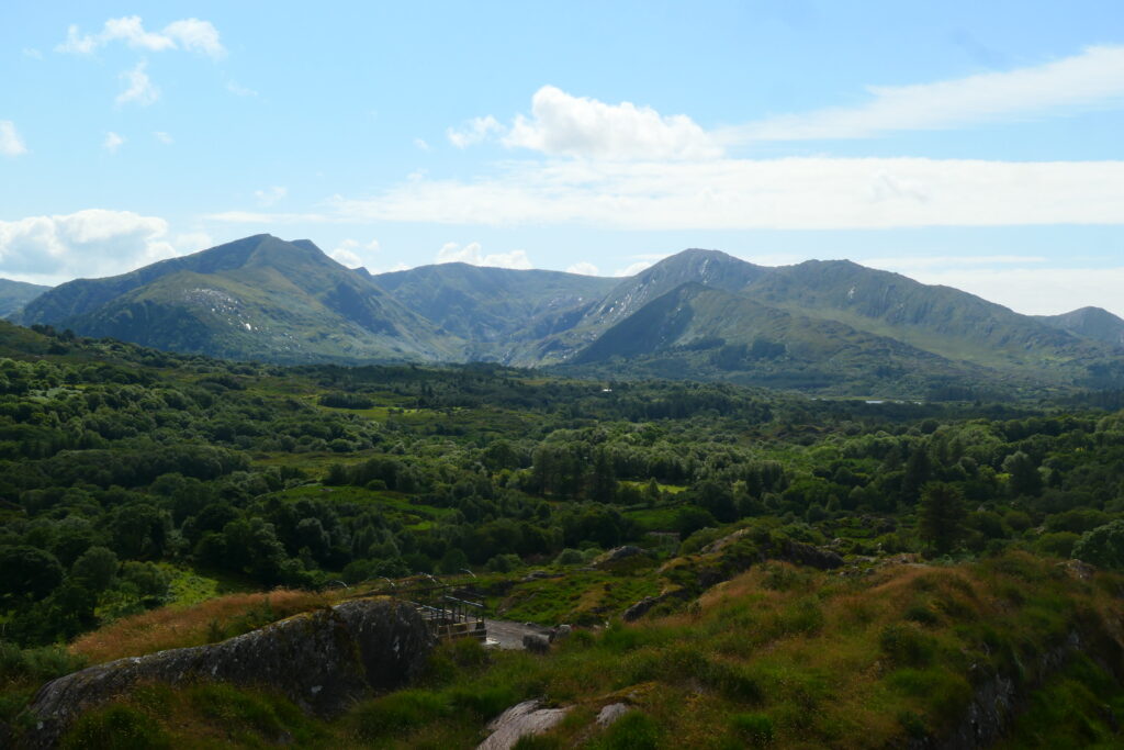
Ross Castle, County Kerry
Ross Castle is a striking 15th-century fortress located on the edge of Lough Leane, near Killarney in County Kerry, in south west Ireland. Nestled within the stunning Killarney National Park, the castle offers breathtaking views of the lake and the surrounding mountains, including the famous Macgillycuddy’s Reeks. The castle, built by the O’Donoghue clan, is a classic example of Irish tower house architecture and remains one of the most visited historic sites in the region.
The castle is known for its well-preserved structure, including its high walls, a round tower, and a fortified bawn (a defensive enclosure). Inside, visitors can explore the castle’s rooms and learn about its fascinating history, which includes a period of siege and the eventual abandonment of the O’Donoghue clan.
One of the most popular activities around Ross Castle is taking a boat trip on Lough Leane. The lake’s waters are calm, and the boat rides offer a unique view of the castle from the water, as well as the surrounding landscape.


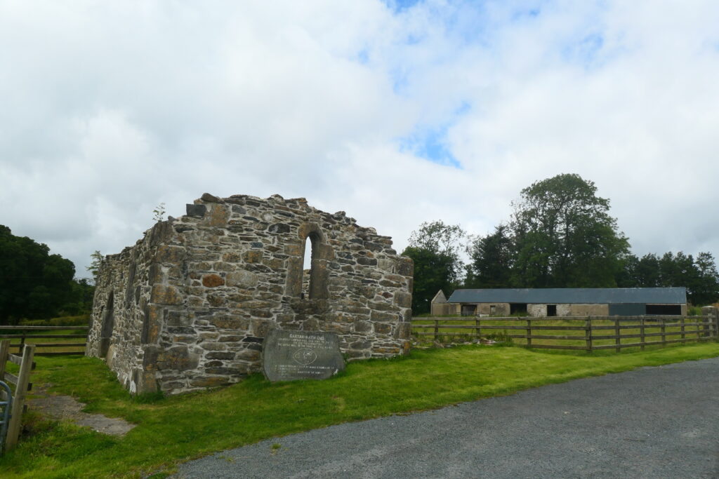
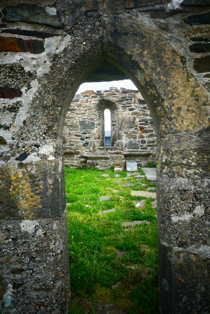
St. Colmcille’s Abbey, County Donegal
The ruins of St. Colmcille’s Abbey are located just to the east of Glenveagh National Park in the north west of Ireland. The site overlooks Lough Akibbon and Lough Gartan.
The Abbey is located in the village of Gallen, and is a historic monastic site that holds great significance in Irish history. Founded by St. Colmcille, also known as St. Columba, around the 6th century, it is believed to have been one of the many monastic communities established by the saint, who played a key role in spreading Christianity throughout Ireland and Scotland.
The abbey is set in a peaceful and scenic location, surrounded by lush countryside and views of the nearby hills. While much of the original structure has been lost to time, some ruins still remain, including the foundations of the church and the remnants of the surrounding walls. The site has become an important pilgrimage location for those who follow St. Colmcille’s legacy.

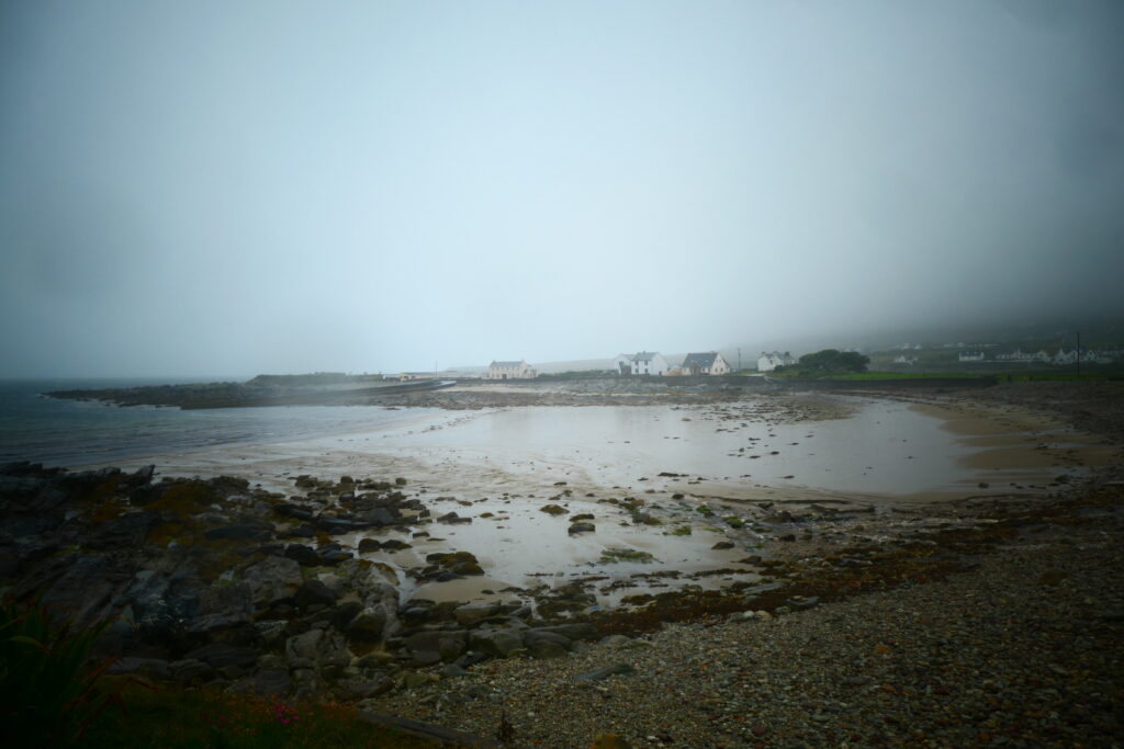
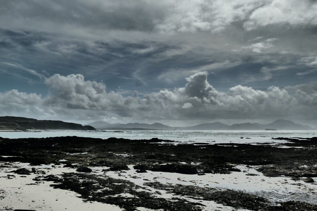
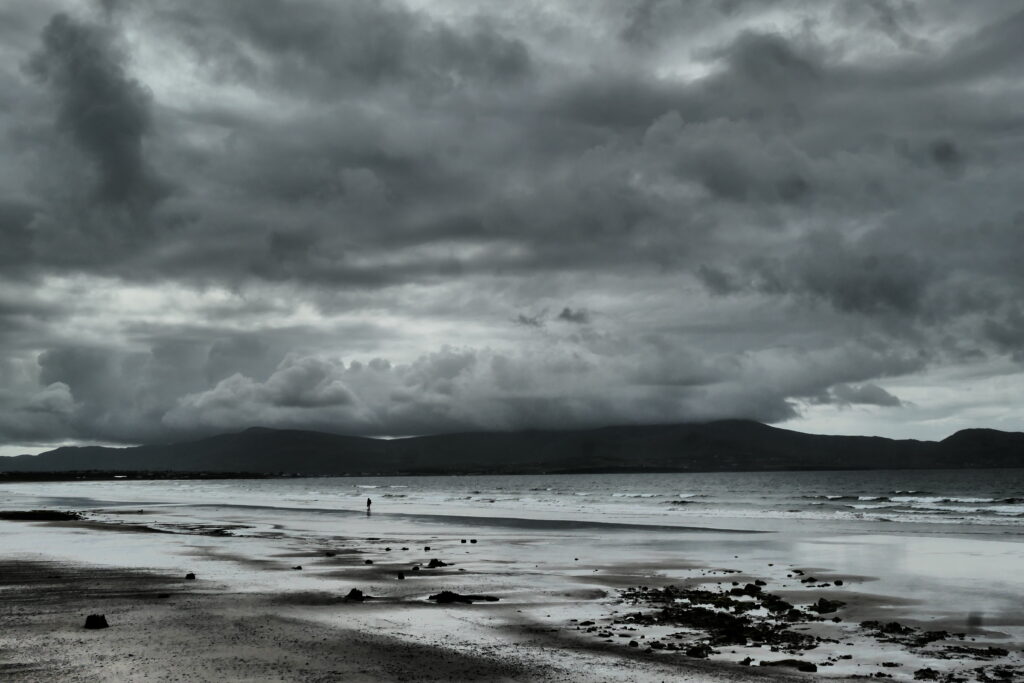
St. Finian’s Bay, County Kerry
St. Finian’s Bay is located in the south west of the Iveragh Peninsula, in south west Ireland, overlooking the Atlantic Ocean. The bay is nestled between the Slieve Mish Mountains and the Atlantic Ocean, offering dramatic views of both rugged hills and the wild coastline. The area is named after St. Finian, an early Christian saint who is said to have lived in the region during the 6th century. The bay is renowned for its sandy beach and clear waters, and its proximity to the Skellig Islands, which are visible from the shore, particularly the Skellig Michael, known for its ancient monastic settlement.
When we were there an overnight storm was just passing. An hour later it was gone. We took some photos and they look like they’re in black and white, but they’re not!


Schull, County Cork
Schull is a small town on the south west coast of Ireland. Just outside there are some magnificent views towards Mizen Head. Situated on the edge of the Roaringwater Bay, Schull is surrounded by dramatic landscapes, with rolling hills, rugged shorelines, and views of nearby islands, including the famous Long Island.
There is also a 5,000 year old Neolithic tomb nearby, named Altar Wedge Tomb, that’s well worth a visit. The ancient tomb is one of the many wedge-shaped tombs found across Ireland, and it provides a glimpse into the burial practices of Ireland’s early inhabitants.
The tomb is named after its altar-like appearance, with a large flat stone slab at its entrance, resembling an altar. It consists of a narrow, wedge-shaped chamber made of large stones, with a number of capstones that once formed a roof. The tomb was likely used for communal burials, with human remains placed inside along with grave goods. It is believed to have been part of a larger ritual landscape, as many wedge tombs are aligned with specific astronomical events, such as the solstices.

Shrove, County Donegal
Shrove is a small hamlet in the north east of the Inishowen peninsula, at the entrance to Lough Foyle, in the far north of Ireland. Situated near the town of Moville, it was historically a fishing community, and remnants of its maritime past can still be seen in the surrounding area. The village is notable for its proximity to the Shrove lighthouse, which sits on the tip of the peninsula. The lighthouse has been guiding ships navigating the entrance to Lough Foyle since 1836.
Sligo, County Sligo
Sligo is a small but vibrant city in the north west of Ireland, with a population of around 20,000 (2022). There are loads of restaurants and cafés, and the people are very friendly. It lies at the mouth of the River Garavogue, where the river flows into Sligo Bay, offering scenic views of the surrounding landscape, including Benbulben Mountain, a distinctive flat-topped peak that dominates the horizon.
The town has a rich history and is known for its connection to the poet W.B. Yeats, who spent much of his childhood in the area and often drew inspiration from the local landscape. The Yeats Memorial Building in the town centre honours his legacy. Sligo is also known for its historic sites, including Sligo Abbey, a 13th-century Dominican monastery, and the nearby Carrowmore Megalithic Cemetery, one of the largest and oldest cemeteries of its kind in Europe.


Tremone Bay beach, County Donegal
Tremone Bay is very secluded, beautiful sandy beach that isn’t very well known. It’s located in the north east of Inishowen peninsula, near the village of Clonmany, in the far north of Ireland. It’s a great place to stop for walking, picnicking, and enjoying the natural scenery. The beach is also known for its clear waters and its potential for swimming, though it’s not typically lifeguarded. It is a more remote and tranquil alternative to some of the more popular beaches in County Donegal.
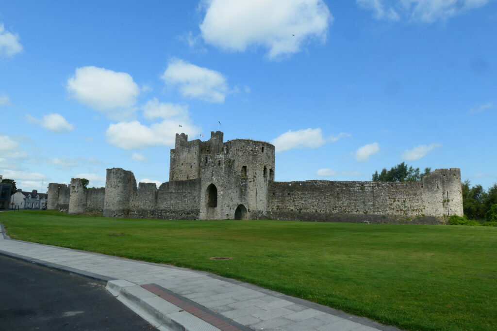
Trim Castle, County Meath
Trim castle is a lovely 12th century Norman castle, well preserved castle located just north of Dublin in Trim, County Meath. It is the largest Norman castle in Ireland, and the keep is unique in that it is cruciform in shape. Trim itself is a small but very busy town and as such parking is severely limited, in particular in the vicinity of the castle.
The castle was built during the reign of King Henry II, by the Anglo-Norman knight Hugh de Lacy, and is situated on the River Boyne to strategically control the surrounding area. The keep was originally surrounded by a defensive wall, a moat, and a series of gates, which helped protect the castle from attack.
Over the centuries, Trim Castle has had various owners and has seen significant changes. It was partially damaged during the Irish Rebellion of 1641 and later fell into disrepair. Despite this, much of the structure remains intact, and it has become a popular tourist attraction. It’s also known for being used as a filming location in the 2005 film Braveheart, in which it doubled for the English-held castle of York.

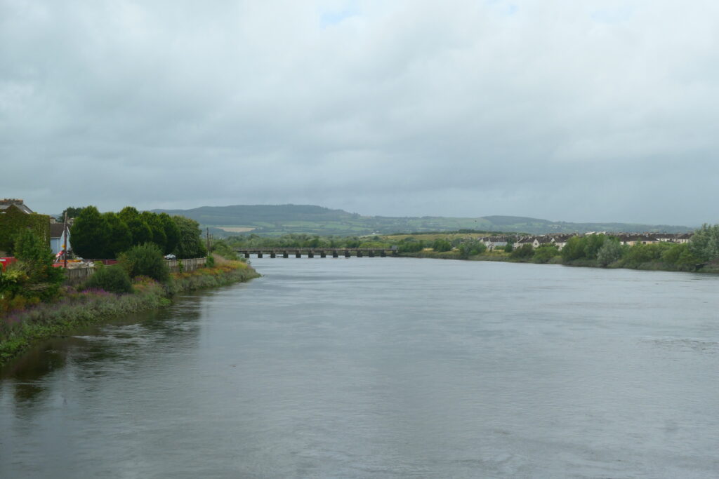
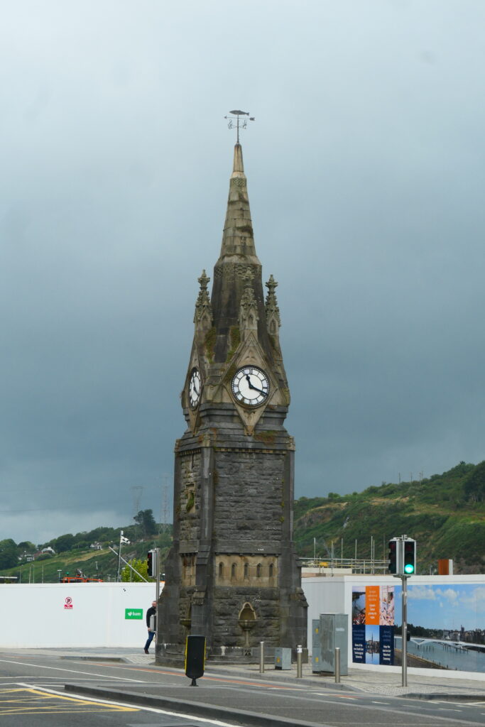
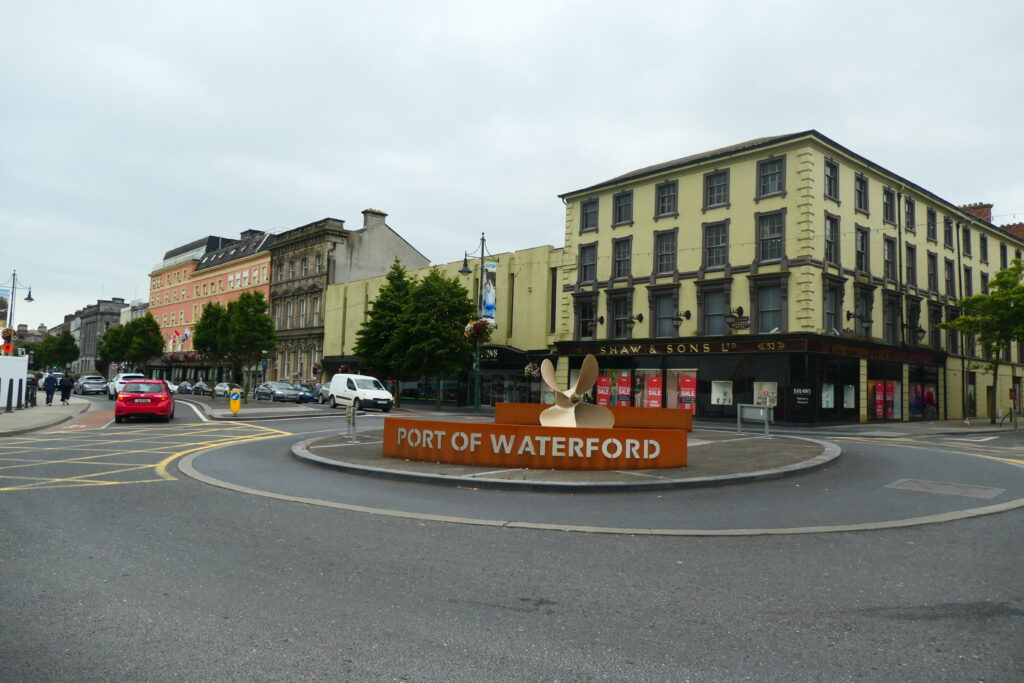
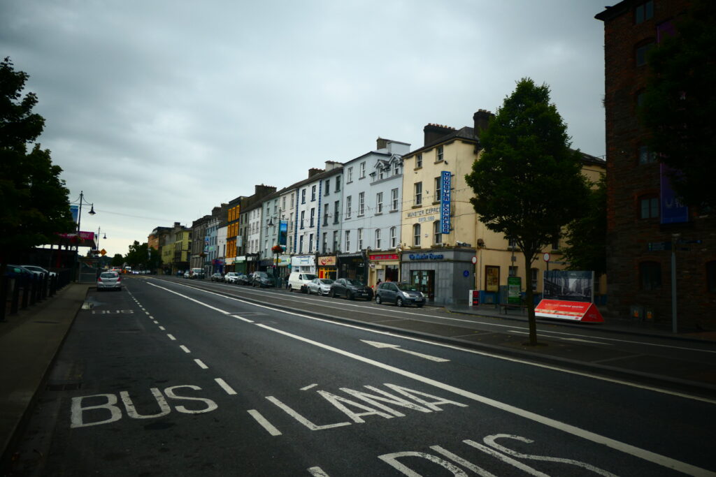
Waterford, County Waterford
Waterford is the oldest city in the Republic of Ireland, having been founded by the Vikings in 914 AD. Located on the coast in south east Ireland, it is undergoing lots of regeneration, especially around the docklands area. Famously, it is the home of glass making.
One of the city’s most famous landmarks is the Waterford Crystal factory, renowned for producing high quality crystal glassware. The factory and its visitor centre allow you to see the craftsmanship involved in creating the iconic crystal pieces. Waterford is also home to several historical sites, such as Reginald’s Tower, which dates back to the Viking era and is one of the oldest urban monuments in Ireland.
We really liked the Strongbow and Aoife Sculpture in Waterford, which is a prominent public artwork located in the heart of the city. It commemorates the historic marriage between Richard de Clare, known as Strongbow, and Aoife MacMurrough, the daughter of the King of Leinster, which took place in 1170. The marriage played a significant role in the Norman invasion of Ireland, because it helped establish the Norman presence in Ireland, leading to the eventual control of large parts of the country by the Normans.


Wicklow, County Wicklow
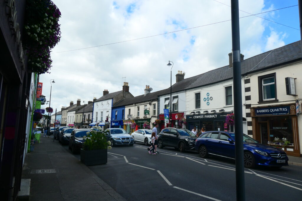
Wicklow is a small town south of Dublin, on the east coast of Ireland, with a population of around 13,000 people (2022). It lies on the Irish Sea coast, at the mouth of the River Vartry, and is often referred to as the Gateway to the Garden of Ireland’, due to its proximity to the scenic Wicklow Mountains.
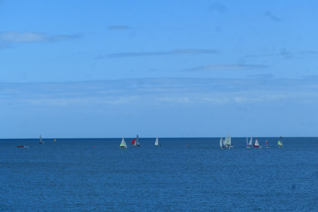
The town is clearly undergoing quite a lot of regeneration, and everyone seemed to be in general good spirits when we visited. The town itself has the usual brightly coloured houses throughout, providing a cheery disposition, and there were people swimming in the sea in the harbour, as well as sunbathing, and learning to sail.
Wicklow has a rich history, dating back to the early medieval period. The town was originally a Viking settlement and later developed into an important monastic centre. There are several historical sites nearby, including the Wicklow Gaol, a former prison that operated from the 18th to the early 20th century, which is now a museum. Another notable site is the Wicklow Cathedral, which dates back to the 13th century and stands as a symbol of the town’s historical significance.


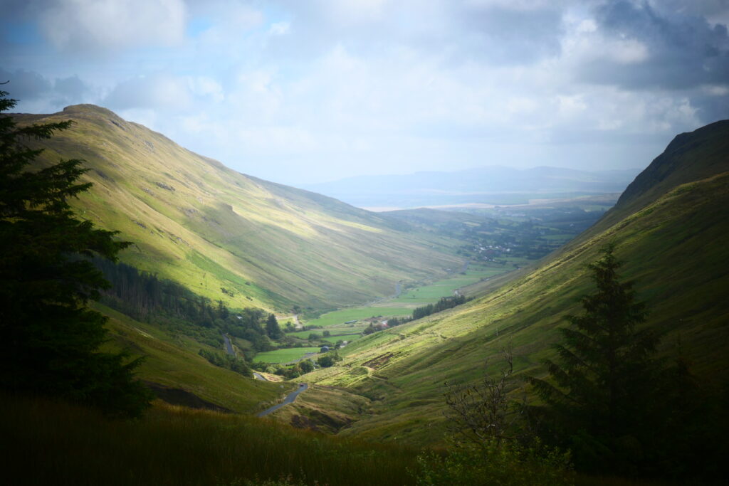
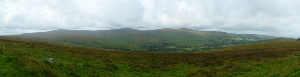
Wicklow mountains, County Wicklow
The Wicklow mountains lie just south of Dublin and cover all of the county of Wicklow. There are many mountains in the area, of varying heights, the highest mountain being Lugnaquilla at 3,035 ft (925m). They cover an area of about 1,500 square kilometres and are part of the larger Leinster Ridge. The range stretches from the outskirts of Dublin to the southern parts of the county, and offers a mix of rugged terrain, scenic valleys, and picturesque lakes.
The Wicklow Mountains National Park was established in 1991 and covers a significant portion of the range, and isa great for hiking, mountain biking and fishing. The region is also rich in archaeological sites, including ancient tombs, stone circles, and remnants of early Christian monastic settlements.


What’s it like to drive in Ireland?
They drive on the left hand side of the road in Ireland.
Driving in Ireland is mostly a leisurely affair, in particular in the more rural areas. Some drivers can be aggressive by driving a few feet behind you, desperately trying to overtake, although this is not common. In rural Éire, there are many very narrow roads and single track roads with intermittent passing points. Driving into verges is common when overtaking.
Do you require an international driving permit in Ireland?
We’ve created a dedicated page to driving abroad, which answers this question, and more, which you might find helpful.
Can you use your UK driving license when driving through Ireland?
We’ve created a dedicated page to driving abroad, which answers this question, and more, which you might find helpful.
Do I need a carnet de passages to drive in Ireland?
We’ve created a dedicated page to driving abroad, which answers this question, and more, which you might find helpful.
What are the speed limits in Ireland?
The speed limits for cars in Ireland are:
- 30 mph (50 km/h) for urban driving
- 50 mph (80 km/h) outside of built up areas
- 60 mph (100 km/h) on dual carriageways
- 75 mph (120 km/h) on motorways
What currency do they use in Ireland?
In the Republic of Ireland they use the Euro, and in Northern Ireland they use the UK pound sterling. The use of credit / debit cards is now widespread, though not guaranteed in Eire, take some cash as backup. Travellers cheques are accepted. There are lots of ATMs in the cities, though they’re sparse in towns and not common at all in villages.
You should make yourself aware of the amount that your bank charges you for using credit and debit cards abroad. Often credit cards are cheaper for purchasing items directly, and for withdrawing cash from ATMs.
What language do they speak in Ireland?
They speak English in both the Republic of Ireland and in Northern Ireland. Officially Irish Gaelic is recognised as the first language of the Republic of Ireland, although only around a third of its people speak the language.
What time zone is Ireland in?
Remember, when you’re planning your next trip to take a look at what time zone it’s in.
Do I need a visa to visit Ireland?
We’ve created a dedicated, more comprehensive page on visas, which you should find helpful. Check it out!
Is wild camping legal in Ireland?
No, wild camping is illegal in Ireland, although in more remote areas it is often tolerated for single nights.
What plug / socket type do they use in Ireland?
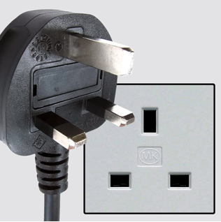
In Ireland they use plug / socket type G.
Health issues in Ireland
Is it safe to drink water in Ireland?
Yes, it is safe to drink tap water in Ireland. Bottled water is also readily available across the country.
What vaccinations are required for Ireland?
This NHS website is kept up to date with all relevant information on vaccinations in Ireland.
Phones in Ireland
What is the country calling code for Ireland?
The country calling code for Ireland is +353
What are the emergency phone numbers in Ireland?
- The emergency number for police in Ireland is: 112 / 999
- In Ireland, the emergency number for ambulance is: 112 / 999
- The emergency number for fire in Ireland is: 112 / 999
If you’ve got some useful info that you’d like to share, let us know!
And don’t forget to check out all the other pictures!